ملف:Archipel des Tuamotu.jpg

حجم هذه المعاينة: 800 × 545 بكسل. البعدان الآخران: 2٬560 × 1٬745 بكسل | 4٬400 × 3٬000 بكسل.
الملف الأصلي (4٬400 × 3٬000 بكسل حجم الملف: 2٫05 ميجابايت، نوع MIME: image/jpeg)
وصف قصير
| ⧼wm-license-information-description⧽ |
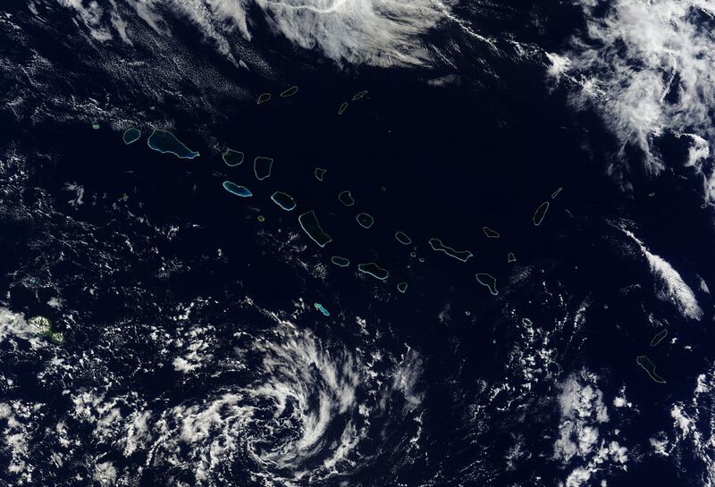
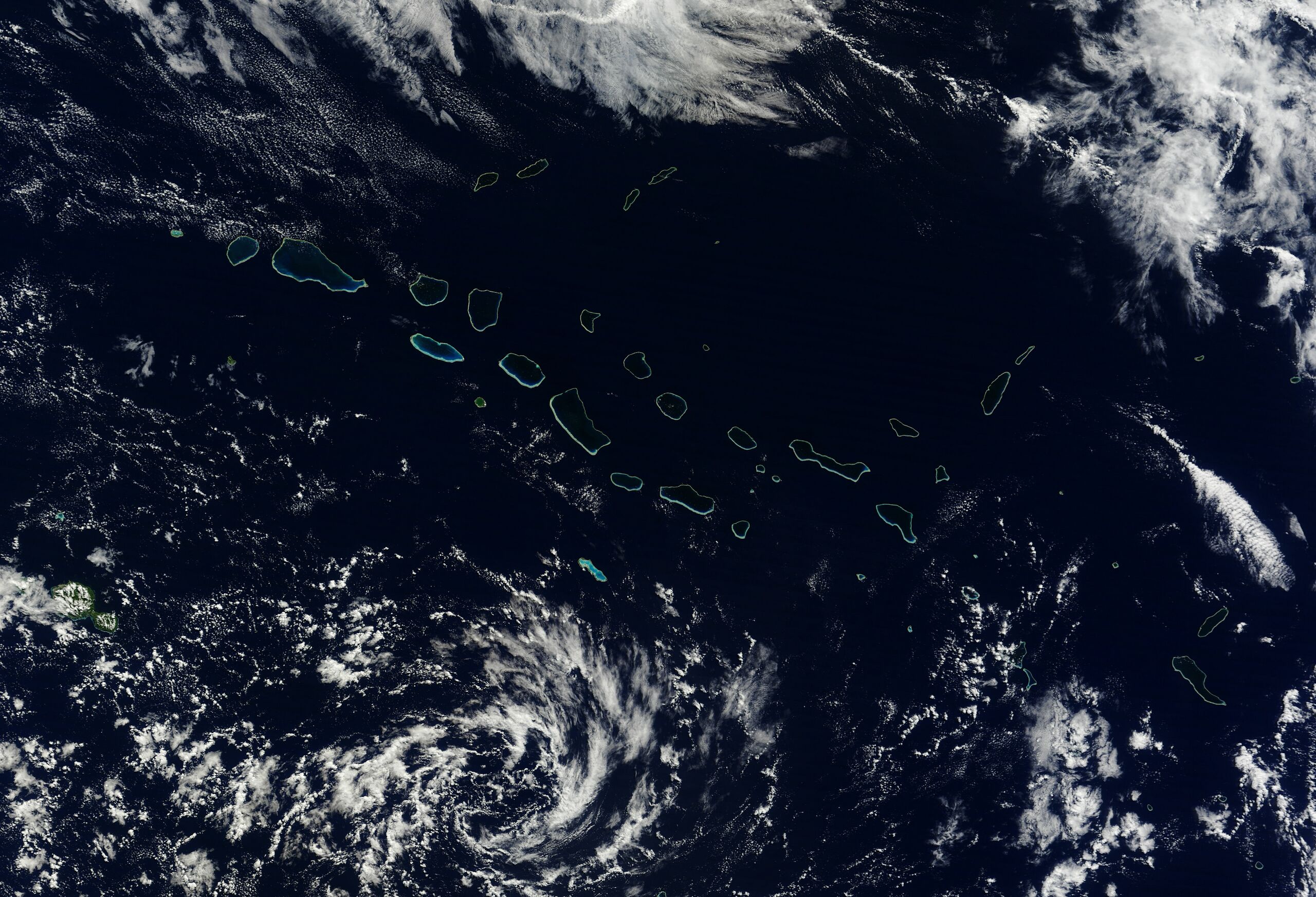
English: Natural-colour image of the north-western portion of the archipelago, including the largest coral atoll in the group, Rangiroa. Delicate rings of iridescent blue-green surround deep blue waters and clouds float overhead. At the north-western extent of the island chain—including islands shown in this image—rocks date to roughly 65 million years ago.
{{country data Спутниковый снимок в естественных цветах северо-западной части архипелага Туамоту, включающая крупнейший атолл — Рангироа. Получен спектрорадиометром MODIS спутника «Терра» 19 мая 2010 года с расстояния 705 км от поверхности Земли. | country flaglink | variant = | size = | name = | altlink = national rugby union team | altvar = rugby union }} |
| ⧼wm-license-information-date⧽ | 2010 |
| ⧼wm-license-information-source⧽ | NASA Earth Observatory |
| ⧼wm-license-information-author⧽ | Jeff Schmaltz |
Image captured by the Moderate Resolution Imaging Spectroradiometer (MODIS) on NASA’s Terra satellite.
ترخيص
تاريخ الملف
اضغط على زمن/تاريخ لرؤية الملف كما بدا في هذا الزمن.
| زمن/تاريخ | صورة مصغرة | الأبعاد | مستخدم | تعليق | |
|---|---|---|---|---|---|
| حالي | ★ مراجعة معتمدة 04:52، 4 يوليو 2025 | | 4٬400 × 3٬000 (2٫05 ميجابايت) | Pastakhov (نقاش | مساهمات) | Upload https://upload.wikimedia.org/wikipedia/commons/8/8d/Archipel_des_Tuamotu.jpg |
لا يمكنك استبدال هذا الملف.
وصلات
لا يوجد صفحات تصل لهذه الصورة.