ملف:Argyre Planitia - Argyre MOLA zoom 64 (cropped).jpg
حجم هذه المعاينة: 599 × 599 بكسل. البعد الآخر: 2٬513 × 2٬515 بكسل.
الملف الأصلي (2٬513 × 2٬515 بكسل حجم الملف: 3٫76 ميجابايت، نوع MIME: image/jpeg)
وصف قصير
| ⧼wm-license-information-description⧽ |
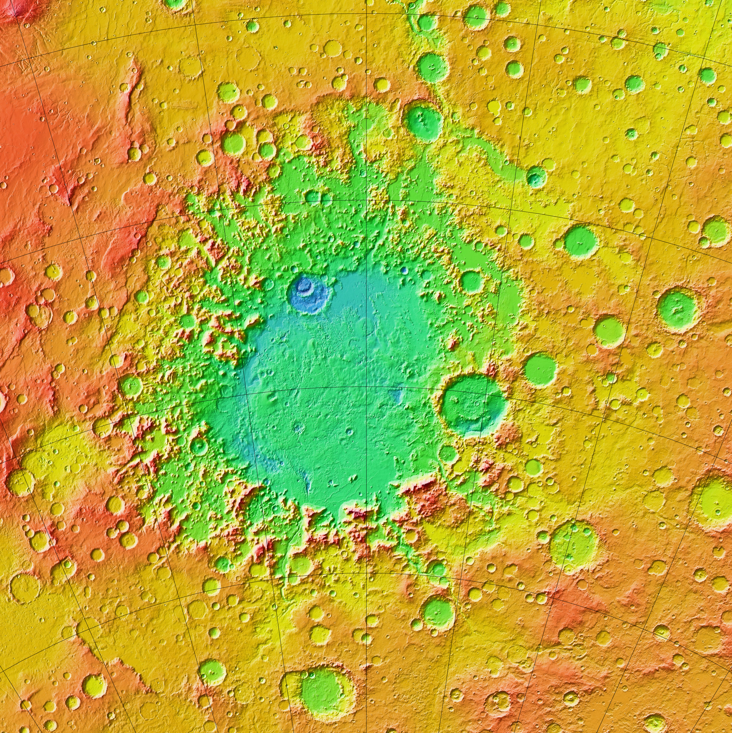
English: A colorized topographic map of the martian impact basin Argyre, together with its surroundings, from the Mars Orbiter Laser Altimeter (MOLA) instrument of the Mars Global Surveyor spacecraft. Argyre, the second deepest basin on Mars, lies in the southern hemisphere, southeast of the canyon system Valles Marineris.
Some of the features in this image have been annotated in Wikimedia Commons. |
| ⧼wm-license-information-date⧽ | 2013, {{time}} – invalid date format 17 (help) |
| ⧼wm-license-information-source⧽ | JMARS |
| ⧼wm-license-information-author⧽ | NASA / JPL-Caltech / Arizona State University |
| ⧼wm-license-information-other-versions⧽ |
ترخيص
تاريخ الملف
اضغط على زمن/تاريخ لرؤية الملف كما بدا في هذا الزمن.
| زمن/تاريخ | صورة مصغرة | الأبعاد | مستخدم | تعليق | |
|---|---|---|---|---|---|
| حالي | ★ مراجعة معتمدة 04:20، 4 يوليو 2025 | | 2٬513 × 2٬515 (3٫76 ميجابايت) | Pastakhov (نقاش | مساهمات) | Upload https://upload.wikimedia.org/wikipedia/commons/0/04/Argyre_Planitia_-_Argyre_MOLA_zoom_64_%28cropped%29.jpg |
لا يمكنك استبدال هذا الملف.
وصلات
لا يوجد صفحات تصل لهذه الصورة.
.jpg&oldid=4135205)