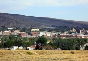
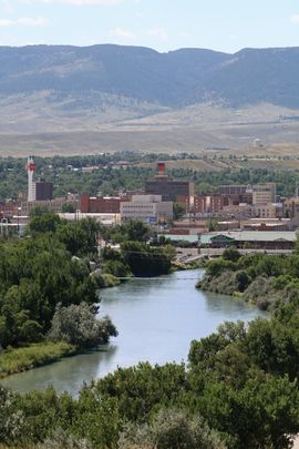
وايومنگ
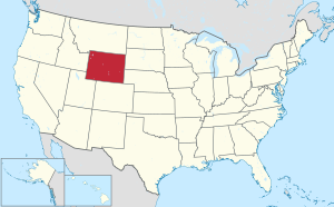
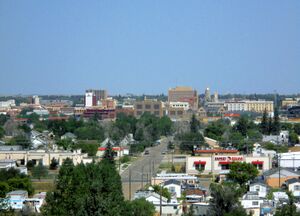
وايومنگ Wyoming هي احدى ولايات الغرب الاميركي التي تمر فيها سلسلة جبال روكي. هي الولاية الاميركية الرابعة والاربعون وعدد السكان فيها يبلغ الـ 509,294 نسمة. العاصمة واكبر مدنها هي شايان. كما توجد فيها جامعة وايومنغ.
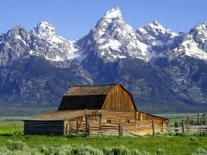
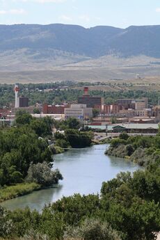
وايومنج إحدى الولايات في منطقة جبال الروكي في الولايات المتحدة الأمريكية، يبلغ عدد سكانها 455,975 نسمة. وتحتل ويومينج المركز الأخير في عدد السكان مقارنة بغيرها من الولايات الأمريكية. وهي تغطي مساحة 253,349 كم². وشيان عاصمة الولاية، وكاسبر هي أكبر المدن. تجذب مناظر ويومينج الجبلية ملايين الزوار كل عام. وفيها اثنان من المتـنزّهات الوطنية للولايات المتحدة الأمريكية هما يلوستون وجراند تيتون.
Indigenous peoples inhabited the region for thousands of years. Historic and currently federally recognized tribes include the Arapaho, Crow, Lakota, and Shoshone. Part of the land that became Wyoming came under American sovereignty via the Louisiana Purchase, part via the Oregon Treaty, and, lastly, via the Mexican Cession. With the opening of the Oregon Trail, the Mormon Trail, and the California Trail, vast numbers of pioneers traveled through parts of the state that had once been traversed mainly by fur trappers, and this spurred the establishment of forts, such as Fort Laramie, that today serve as population centers.[6] The Transcontinental Railroad supplanted the wagon trails in 1867 with a route through southern Wyoming,[7] bringing new settlers and the establishment of founding towns, including the state capital of Cheyenne.[8] On March 27, 1890, Wyoming became the union's 44th state.[1]
The Republican presidential nominee has carried the state in every election since 1968.[9] Wyoming was the first state to allow women the right to vote (after New Jersey, which had allowed it until 1807), and the right to assume elected office, as well as the first state to elect a female governor. In honor of this part of its history, its official nickname is "The Equality State" and its official state motto is "Equal Rights".[1]
Farming and ranching, and the attendant range wars, feature prominently in the state's history. Wyoming's economy is largely based on tourism and the extraction of minerals such as coal, natural gas, oil, and trona. Its agricultural commodities include barley, hay, livestock, sugar beets, wheat, and wool. Wyoming does not require the beneficial owners of LLCs to be disclosed in the filing, which creates an opportunity for a tax haven. Wyoming levies no individual or corporate income tax and no tax on retirement income.
أصل الاسم
The region had acquired the name Wyoming by 1865 when Representative James Mitchell Ashley of Ohio introduced a bill to Congress to provide a "temporary government for the territory of Wyoming". The territory was named after the Wyoming Valley in Pennsylvania. Thomas Campbell wrote his 1809 poem "Gertrude of Wyoming", inspired by the Battle of Wyoming in the American Revolutionary War. The name ultimately derives from the Lenape Munsee word xwé:wamənk ("at the big river flat").[10][11]
التاريخ
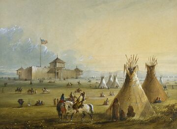
سكن الهنود الامريكيون وايومنگ منذ مئات السنين. ومنهم قبائل كرو, أراباهو, سو، شوشوني. وصلها المستكشفون الفرنسيون من حدودها الشمالية في نهايات الـ 1700. جان كولتر الذي كان عضوا في بعثة لويس و كلارك الاستكشافية كان على الارجح اول رجل ابيض يصل اليها ويدخلها وذلك في عام 1807. تقاريره عن منطقة يلوستون اعتبرت وقتها خيالية! اقامت خطوط يونيون باسيفيك الحديدية سكة حديد تقطع الولاية من شرقها إلى غربها على امتداد الحدود الجنوبية في عام 1868. على نفس الخط اقيم لاحقا طريق رقم 80.
أقيمت شايان العاصمة في عام 1868. في 25 يوليو 1868 اعلن رسميا عن انشاء مقاطعة وايومنغ, على النقيض من الولايات المجاورة لم تشهد وايومنغ اي زيادة تذكر في عدد السكان. في عام 1872 اعلن الكونجرس الاميركي عن انشاء اول محمية وطنية في العالم في منطقة يلوستون في 10 يوليو 1890 تم قبول وايومنغ في الاتحاد الاميركي لتكون بذلك الولاية الـ 44. في مسعاها للحصول على عدد كاف من الاصوات لتتحول إلى ولاية اميركية سمحت وايومنغ للنساء بالتصويت لتكون اول ولاية اميركية تسمح لهن بالتصويت وذلك في عام 1869. وقد كانت اول ولاية امريكية تنتخب امرآة حاكما عليها واسمها نيلي تايلور روس
عاش الهنود الأمريكيون في منطقة وايومينج منذ ما لا يقل عن 11,000 سنة. وقد دخل الصيادون الفرنسيون المنطقة ربما في منتصف القرن الثامن عشر الميلادي. وقد حازت الولايات المتحدة معظم المنطقة من فرنسا عام 1803م، جزءًا من صفقة شراء لويزيانا. وقد اجتاز فريق لتجارة الفراء الجبال عام 1812م من خلال الممر الجنوبي.
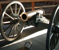
وقد أُسِّسَ حصن وليم (حصن لارامي فيما بعد)، باعتباره أول مركز تجاري دائم في ويومينج، عام 1834م. وفي عام 1872م، أصبحت يلوستون أول متنزه وطني في الولايات المتحدة الأمريكية. وفي عام 1883م، حُفر أول بئر للبترول في دالاس فيلد بالقرب من لاندر.
وأصبحت وايومينج الولاية الرابعة والأربعين في الولايات المتحدة الأمريكية، في 10 يوليو 1890م. وفي خمسينيات القرن العشرين، وجدت أماكن هامة لمعدن اليورانيوم في الولاية. وافتتحت أول قاعدة للصواريخ عابرة القارات في الولايات المتحدة الأمريكية عام 1960م، قرب بلدة شيان. وفي الثمانينيات من القرن العشرين، سبب الطلب المتناقص لليورانيوم والفحم الحجري والبترول تراجعًا في اقتصاد الولاية.
On December 10, 1869, territorial Governor John Allen Campbell extended the right to vote to women, making Wyoming the first territory to do so, and upon statehood became the first state to grant women's suffrage.[12] Women first served on juries in Wyoming (Laramie in 1870). Wyoming was also a pioneer in welcoming women into electoral politics.[13] It had the first female court bailiff (Mary Atkinson, Laramie, in 1870), and the first female justice of the peace in the country (Esther Hobart Morris, South Pass City, in 1870). In 1924, Wyoming was the first state to elect a female governor, Nellie Tayloe Ross, who took office in January 1925.[14] Due to its civil-rights history, one of Wyoming's state nicknames is "The Equality State", and the official state motto is "Equal Rights".[1]
Wyoming's constitution also included a pioneering article on water rights.[15] Bills for Wyoming Territory's admission to the union were introduced in both the U.S. Senate and U.S. House of Representatives in December 1889. On March 27, 1890, the House passed the bill and President Benjamin Harrison signed Wyoming's statehood bill; Wyoming became the 44th state in the union.[1]
Wyoming was the location of the Johnson County War of 1892, which erupted between competing groups of cattle ranchers. The passage of the Homestead Act led to an influx of small ranchers. A range war broke out when either or both of the groups chose violent conflict over commercial competition in the use of the public land.
الجغرافيا والطقس
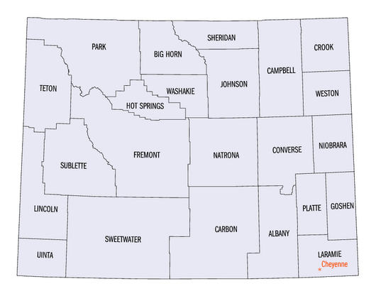
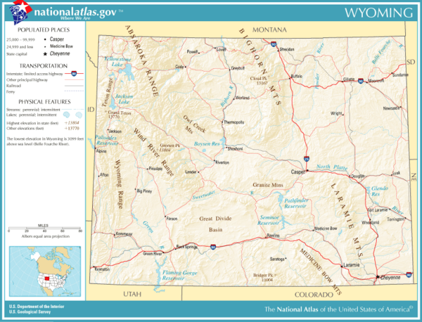
تحد وايومنگ من الشمال ولاية مونتانا ومن الشرق داكوتا الجنوبية و نبراسكا و من الجنوب كولورادو ومن الغرب يوتا وأيداهو. وايومنگ هي احدى ثلاث ولايات محددة بالكامل بخطوط مستقيمة. هي الولاية التاسعة من حيث المساحة ومساحتها 97,914 ميل مربع (253,596 كم مربع) وتتكون من 23 مقاطعة. تعتبر وايومنگ ولاية جافة حيث الامطار فيها قليلة مقارنة بالولايات الاخرى.
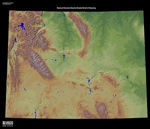
تمتد جبال الروكي عبر وايومنگ في سلسلة جبلية ضخمة. وترتفع قمة جانيت، أعلى قمة في الولاية، 4,207م في سلسلة ويند ريفر. وتبدأ أجزاء من الأنظمة النهرية لأنهار ميسوري وكلورادو وكولومبيا في جبال ولاية وايومنگ. وتقع عدة أراضٍ مسطحة تسمى أحواض بين جبلية بين سلاسل الجبال العديدة في ويومينج. وتغطي السهول الكبرى معظم الأجزاء الشرقية للولاية. وتشغل الهضاب السود معظم الزاوية الشمالية الشرقية لويومينج.
الطقس
Wyoming's climate is generally semi-arid and continental (Köppen climate classification BSk) and is drier and windier in comparison to most of the United States with greater temperature extremes.[16][17] Much of this is due to the topography of the state. Summers in Wyoming are warm with July high temperatures averaging between 80 و 90 °F (27 و 32 °C) in most of the state. With increasing elevation, however, this average drops rapidly with locations above 9،000 أقدام (2،700 m) averaging around 70 °F (21 °C). Summer nights throughout the state are characterized by a rapid cooldown with even the hottest locations averaging in the 50–60 °F (10–16 °C) range at night. In most of the state, most of the precipitation tends to fall in the late spring and early summer. Winters are cold but are variable with periods of sometimes extreme cold interspersed between generally mild periods, with Chinook winds providing unusually warm temperatures in some locations.
Wyoming is a dry state with much of the land receiving less than 10 بوصات (250 mm) of rainfall per year. Precipitation depends on elevation with lower areas in the Big Horn Basin averaging 5–8 بوصات (130–200 mm), making the area nearly a true desert. The lower areas in the North and on the eastern plains typically average around 10–12 بوصات (250–300 mm), making the climate there semi-arid. Some mountain areas do receive a good amount of precipitation, 20 بوصات (510 mm) or more, much of it as snow, sometimes 200 بوصات (510 cm) or more annually. The state's highest recorded temperature is 114 °F (46 °C) at Basin on July 12, 1900, and the lowest recorded temperature is −66 °F (−54 °C) at Riverside on February 9, 1933.
The number of thunderstorm days varies across the state with the southeastern plains of the state having the most days of thunderstorm activity. Thunderstorm activity in the state is highest during the late spring and early summer. The southeastern corner of the state is the most vulnerable part of the state to tornado activity. Moving away from that point and westwards, the incidence of tornadoes drops dramatically with the west part of the state showing little vulnerability. Tornadoes, where they occur, tend to be small and brief, unlike some of those that occur farther east.
| طقس كاسپر: متوسط درجات الحرارة العظمى والصغرى، ومتوسط هطول الأمطار. | ||||||||||||||
|---|---|---|---|---|---|---|---|---|---|---|---|---|---|---|
| الشهر | Jan | Feb | Mar | Apr | May | Jun | Jul | Aug | Sep | Oct | Nov | Dec | السنة | |
| متوسط درجة العظمى °ف (°س) | 32 (0) |
37 (3) |
45 (7) |
56 (13) |
66 (19) |
78 (26) |
87 (31) |
85 (29) |
74 (23) |
60 (16) |
44 (7) |
34 (1) |
58 (14) | |
| متوسط درجة الحرارة الدنيا °ف (°س) |
12 (-11) |
16 (-9) |
21 (-6) |
28 (-2) |
37 (3) |
46 (8) |
54 (12) |
51 (11) |
41 (5) |
32 (0) |
21 (-6) |
14 (-10) |
31 (-1) | |
| متوسط سقوط الأمطار بوصة (مم) |
0.6 (15.2) |
0.6 (15.2) |
1.0 (25.4) |
1.6 (40.6) |
2.1 (53.3) |
1.5 (38.1) |
1.3 (33.0) |
0.7 (17.8) |
0.9 (22.9) |
1.0 (25.4) |
0.8 (20.3) |
0.7 (17.8) |
12.8 (325.1) | |
| المصدر:[18] | ||||||||||||||
| مناخ جاكسون: متوسطات درجتي الحرارة العظمى والصغرى، ومتوسط هطول الأمطار. | ||||||||||||||
|---|---|---|---|---|---|---|---|---|---|---|---|---|---|---|
| الشهر | Jan | Feb | Mar | Apr | May | Jun | Jul | Aug | Sep | Oct | Nov | Dec | العام | |
| متوسط درجة الحرارة العظمى °F (°C) | 24 (-4) |
28 (-2) |
37 (3) |
47 (8) |
58 (14) |
68 (20) |
78 (26) |
77 (25) |
67 (19) |
54 (12) |
37 (3) |
24 (-4) |
49 (9) | |
| متوسط درجة الحرارة الدنيا °ف (°س) |
-1 (-18) |
2 (-17) |
10 (-12) |
21 (-6) |
30 (-1) |
36 (2) |
41 (5) |
38 (3) |
31 (-1) |
22 (-6) |
14 (-10) |
0 (-18) |
20 (-7) | |
| متوسط سقوط الأمطار بوصة (مم) |
2.6 (66.0) |
1.9 (48.3) |
1.6 (40.6) |
1.4 (35.6) |
1.9 (48.3) |
1.8 (45.7) |
1.3 (33.0) |
1.3 (33.0) |
1.5 (38.1) |
1.3 (33.0) |
2.3 (58.4) |
2.5 (63.5) |
21.4 (543.6) | |
| المصدر:[19] | ||||||||||||||
Location and size
As specified in the designating legislation for the Territory of Wyoming, Wyoming's borders are lines of latitude 41°N and 45°N, and longitude 104°3'W and 111°3'W (27 and 34 west of the Washington Meridian)—a geodesic quadrangle.[20] Wyoming is one of only three states (the others being Colorado and Utah) to have borders defined by only "straight" lines. Due to surveying inaccuracies during the 19th century, Wyoming's legal border deviates from the true latitude and longitude lines by up to واحد من اثنان ميل (0.80 km) in some spots, especially in the mountainous region along the 45th parallel.[21] Wyoming is bordered on the north by Montana, on the east by South Dakota and Nebraska, on the south by Colorado, on the southwest by Utah, and on the west by Idaho. It is the tenth largest state in the United States in total area, containing 97،814 ميل مربع (253،340 km2) and is made up of 23 counties. From the north border to the south border, it is 276 ميل (444 km); and from the east to the west border is 365 ميل (587 km) at its south end and 342 ميل (550 km) at the north end.
Natural landforms
Mountain ranges

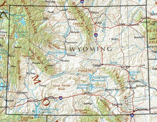
The Great Plains meet the Rocky Mountains in Wyoming. The state is a great plateau broken by many mountain ranges. Surface elevations range from the summit of Gannett Peak in the Wind River Mountain Range, at 13،804 أقدام (4،207 m), to the Belle Fourche River valley in the state's northeast corner, at 3،125 أقدام (952 m). In the northwest are the Absaroka, Owl Creek, Gros Ventre, Wind River, and the Teton ranges. In the north central are the Big Horn Mountains; in the northeast, the Black Hills; and in the southern region the Laramie, Snowy, and Sierra Madre ranges.
The Snowy Range in the south-central part of the state is an extension of the Colorado Rockies both in geology and in appearance. The Wind River Range in the west central part of the state is remote and includes more than 40 mountain peaks in excess of 13،000 ft (4،000 m) tall in addition to Gannett Peak, the highest peak in the state. The Bighorn Mountains in the north-central portion are somewhat isolated from the bulk of the Rocky Mountains.
The Teton Range in the northwest extends for 50 ميل (80 km), part of which is included in Grand Teton National Park. The park includes the Grand Teton, the second-highest peak in the state.
The Continental Divide spans north–south across the central portion of the state. Rivers east of the divide drain into the Missouri River Basin and eventually the Gulf of Mexico. They are the North Platte, Wind, Bighorn, and Yellowstone rivers. The Snake River in northwest Wyoming eventually drains into the Columbia River and the Pacific Ocean, as does the Green River through the Colorado River Basin.
The Continental Divide forks in the south-central part of the state in an area known as the Great Divide Basin where water that precipitates onto or flows into it cannot reach an ocean—it all sinks into the soil and eventually evaporates.
Several rivers begin in or flow through the state, including the Yellowstone River, Bighorn River, Green River, and the Snake River.
الأحواض
Much of Wyoming is covered with large basins containing different eco-regions, from shrublands to smaller patches of desert.[22] Regions of the state classified as basins contain everything from large geologic formations to sand dunes and vast unpopulated spaces.[23] Basin landscapes are typically at lower elevations and include rolling hills, valleys, mesas, terraces and other rugged terrain, but also include natural springs as well as rivers and artificial reservoirs.[24] They have common plant species such as various subspecies of sagebrush, juniper and grasses such as wheatgrass, but basins are known for their diversity of plant and animal species.[22]
الجزر
Wyoming has 32 named islands; the majority are in Jackson Lake and Yellowstone Lake, within Yellowstone National Park in the northwest portion of the state. The Green River in the southwest also contains a number of islands.
المناطق والتقسيمات الإدارية
المقاطعات
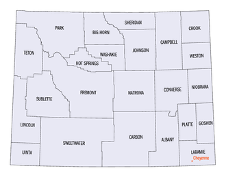
The state of Wyoming has 23 counties.
| Rank | County | Population | Rank | County | Population |
|---|---|---|---|---|---|
| 1 | Laramie | 100,512 | 13 | Converse | 13,751 |
| 2 | Natrona | 79,955 | 14 | Goshen | 12,498 |
| 3 | Campbell | 47,026 | 15 | Big Horn | 11,521 |
| 4 | Sweetwater | 42,272 | 16 | Sublette | 8,728 |
| 5 | Fremont | 39,234 | 17 | Platte | 8,605 |
| 6 | Albany | 37,066 | 18 | Johnson | 8,447 |
| 7 | Sheridan | 30,921 | 19 | Washakie | 7,685 |
| 8 | Park | 29,624 | 20 | Crook | 7,181 |
| 9 | Teton | 23,331 | 21 | Weston | 6,838 |
| 10 | Uinta | 20,450 | 22 | Hot Springs | 4,621 |
| 11 | Lincoln | 19,581 | 23 | Niobrara | 2,467 |
| 12 | Carbon | 14,537 | Wyoming Total | 576,851 | |
Wyoming license plates have a number on the left that indicates the county where the vehicle is registered, ranked by an earlier census.[26] Specifically, the numbers are representative of the property values of the counties in 1930.[27] The county license plate numbers are:
| License Plate Prefix |
County | License Plate Prefix |
County | License Plate Prefix |
County |
|---|---|---|---|---|---|
| 1 | Natrona | 9 | Big Horn | 17 | Campbell |
| 2 | Laramie | 10 | Fremont | 18 | Crook |
| 3 | Sheridan | 11 | Park | 19 | Uinta |
| 4 | Sweetwater | 12 | Lincoln | 20 | Washakie |
| 5 | Albany | 13 | Converse | 21 | Weston |
| 6 | Carbon | 14 | Niobrara | 22 | Teton |
| 7 | Goshen | 15 | Hot Springs | 23 | Sublette |
| 8 | Platte | 16 | Johnson |
Cities and towns
The State of Wyoming has 99 incorporated municipalities.
| Rank | City | County | Population |
|---|---|---|---|
| 1 | Cheyenne | Laramie | 65,132 |
| 2 | Casper | Natrona | 59,038 |
| 3 | Gillette | Campbell | 33,403 |
| 4 | Laramie | Albany | 31,407 |
| 5 | Rock Springs | Sweetwater | 23,526 |
| 6 | Sheridan | Sheridan | 18,737 |
| 7 | Green River | Sweetwater | 11,825 |
| 8 | Evanston | Uinta | 11,747 |
| 9 | Jackson | Teton | 10,760 |
| 10 | Riverton | Fremont | 10,682 |
| 11 | Cody | Park | 10,028 |
| 12 | Rawlins | Carbon | 8,221 |
| 13 | Lander | Fremont | 7,546 |
| 14 | Powell | Park | 6,419 |
| 15 | Douglas | Converse | 6,386 |
| 16 | Torrington | Goshen | 6,119 |
In 2020, 51.1% of Wyomingites lived in one of the 12 most populous Wyoming municipalities.
Metropolitan areas
The United States Census Bureau has defined two metropolitan statistical areas (MSA) and eight micropolitan statistical areas (MiSA) for the state. In 2020, 31.3% of Wyomingites lived in either of the metropolitan statistical areas, and 80.4% lived in either a metropolitan or a micropolitan area.
| Census Area | County | Population |
|---|---|---|
| Cheyenne | Laramie | 100,512 |
| Casper | Natrona | 79,955 |
| Gillette | Campbell | 47,026 |
| Rock Springs | Sweetwater | 42,272 |
| Riverton | Fremont | 39,234 |
| Laramie | Albany | 37,066 |
| Jackson | Teton County, Wyoming | 23,331 |
| Teton County, Idaho | 11,630 | |
| Total | 34,961 | |
| Sheridan | Sheridan | 30,233 |
| Cody | Park | 29,624 |
| Evanston | Uinta County, Wyoming | 20,450 |
| Rich County, Utah | 2,510 | |
| Total | 22,960 |
السكان
| التعداد | Pop. | ملاحظة | %± |
|---|---|---|---|
| 1870 | 9٬118 | — | |
| 1880 | 20٬789 | 128�0% | |
| 1890 | 62٬555 | 200٫9% | |
| 1900 | 92٬531 | 47٫9% | |
| 1910 | 145٬965 | 57٫7% | |
| 1920 | 194٬402 | 33٫2% | |
| 1930 | 225٬565 | 16�0% | |
| 1940 | 250٬742 | 11٫2% | |
| 1950 | 290٬529 | 15٫9% | |
| 1960 | 330٬066 | 13٫6% | |
| 1970 | 332٬416 | 0٫7% | |
| 1980 | 469٬557 | 41٫3% | |
| 1990 | 453٬588 | −3٫4% | |
| 2000 | 493٬782 | 8٫9% | |
| 2010 | 563٬626 | 14٫1% | |
| 2020 | 576٬851 | 2٫3% | |
| 2024 (تق.) | 587٬618 | [28] | 1٫9% |
| Sources: 1910–2020[29] | |||
Population
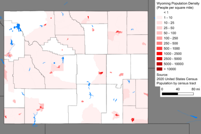
The 2020 United States census counted 576,851 people living in Wyoming.[30] The center of population of Wyoming is in Natrona County.[31][32] Sparsely populated, Wyoming is the least populous state of the United States. Wyoming has the second-lowest population density in the country (behind Alaska) and is the sparsest-populated of the 48 contiguous states. It is one of only two states with a population smaller than that of the nation's capital; the only other state with this distinction is Vermont.
According to HUD's 2022 Annual Homeless Assessment Report, there were an estimated 648 homeless people in Wyoming.[33][34]
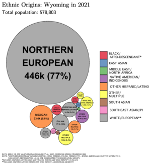
According to the 2020 census, the population's racial composition was 84.7% white (81.4% non-Hispanic white), 2.4% American Indian and Alaska Native, 0.9% Black or African American, 0.9% Asian American, and 0.1% Native Hawaiian or Pacific Islander, 3.5% from some other race, and 7.5% from two or more races.[35] As of 2011, 24.9% of Wyoming's population younger than age 1 were minorities.[36] According to data from the American Community Survey, as of 2018, Wyoming was the only U.S. state where African Americans earn a higher median income than white workers.[37]
As of 2015, Wyoming had an estimated population of 586,107, which was an increase of 1,954, or 0.29%, from the prior year and an increase of 22,481, or 3.99%, since the 2010 census. This includes a natural increase since the last census of 12,165 (33,704 births minus 21,539 deaths) and an increase from net migration of 4,035 into the state. Immigration resulted in a net increase of 2,264 and migration within the country produced a net increase of 1,771. In 2004, the foreign-born population was 11,000 (2.2%). In 2005, total births in Wyoming were 7,231 (birth rate of 14.04 per thousand).[38]
Wyoming experienced its first population decline since 1990, with a decrease of just over 1,000 people (0.2 percent) from July 2015 to July 2016. This decline was attributed to the downturn in the state's mineral extraction industry, particularly the oil and gas sector, which led to the loss of thousands of jobs. However, state economist Jim Robinson noted signs of economic stabilization. Job losses in the oil and gas industry appeared to have leveled off, and there was a slight increase in drilling activity in recent months. While the state's economy showed little growth, it was considered to have reached a more stable condition as of late 2016.[39]
According to the 2000 census, the largest ancestry groups in Wyoming were: German (25.9%), English (15.9%), Irish (13.3%), and American Indian (4.7%). An additional 6.4% responded with "American" as their ancestry.[40]
In 2018, the top countries of origin for Wyoming's immigrants were Mexico, China, Germany, England and Canada.[41]
- Birth data
Note: Births in table do not add up, because Hispanics are counted both by their ethnicity and by their race, giving a higher overall number.
| Race | 2013[42] | 2014[43] | 2015[44] | 2016[45] | 2017[46] | 2018[47] | 2019[48] | 2020[49] | 2021[50] | 2022[51] | 2023[52] |
|---|---|---|---|---|---|---|---|---|---|---|---|
| White | 6,136 (80.3%) | 6,258 (81.3%) | 6,196 (79.8%) | 5,763 (78.0%) | 5,426 (78.6%) | 5,078 (77.4%) | 5,158 (78.6%) | 4,762 (77.7%) | 4,882 (78.3%) | 4,622 (76.4%) | 4,553 (76.0%) |
| Native American | 305 (4.0%) | 294 (3.8%) | 294 (3.8%) | 200 (2.7%) | 206 (3.0%) | 219 (3.3%) | 198 (3.0%) | 176 (2.9%) | 179 (2.9%) | 178 (2.9%) | 150 (2.5%) |
| Asian | 124 (1.6%) | 108 (1.4%) | 135 (1.7%) | 100 (1.3%) | 79 (1.1%) | 72 (1.1%) | 73 (1.1%) | 58 (0.9%) | 67 (1.1%) | 64 (1.1%) | 68 (1.1%) |
| Black | 125 (1.6%) | 116 (1.5%) | 119 (1.5%) | 63 (0.9%) | 45 (0.7%) | 57 (0.9%) | 61 (0.9%) | 55 (0.9%) | 48 (0.8%) | 46 (0.7%) | 38 (0.6%) |
| Hispanic (any race) | 926 (12.1%) | 895 (11.6%) | 963 (12.4%) | 973 (13.2%) | 892 (12.9%) | 851 (13.0%) | 839 (12.8%) | 818 (13.3%) | 749 (12.0%) | 835 (13.8%) | 858 (14.3%) |
| Total | 7,644 (100%) | 7,696 (100%) | 7,765 (100%) | 7,386 (100%) | 6,903 (100%) | 6,562 (100%) | 6,565 (100%) | 6,128 (100%) | 6,237 (100%) | 6,049 (100%) | 5,990 (%) |
- Since 2016, data for births of White Hispanic origin are not collected, but included in one Hispanic group; persons of Hispanic origin may be of any race.
Languages
In 2010, 93.39% (474,343) of Wyomingites over age 5 spoke English as their primary language; 4.47% (22,722) spoke Spanish, 0.35% (1,771) spoke German, and 0.28% (1,434) spoke French. Other common non-English languages included Algonquian (0.18%), Russian (0.10%), Tagalog, and Greek (both 0.09%).[53]
In 2007, the American Community Survey reported 6.2% (30,419) of Wyoming's population over five spoke a language other than English at home. Of those, 68.1% were able to speak English very well, 16.0% spoke English well, 10.9% did not speak English well, and 5.0% did not speak English at all.[54]
Religion
Religious self-identification, Public Religion Research Institute's 2020 American Values Atlas survey.[55]
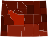
In 2020, the Public Religion Research Institute determined that about 55% of Wyoming's adult population was Christian, primarily evangelical and mainline Protestant, Roman Catholic, and Mormon.[56] The Public Religion Research Institute survey documented a decrease in religiosity from a 2014 separate Pew Research Center study;[57] according to the Public Religion Research Institute, the unaffiliated made up 40% of the state population by 2020. According to a 2013 Gallup poll, Wyomingites' religious affiliations were 49% Protestant, 23% nonreligious or other, 18% Catholic, 9% Latter-day Saint (Mormons), and less than 1% Jewish.[58]
A 2010 Association of Religion Data Archives (ARDA) report recognized as Wyoming's largest denominations the Church of Jesus Christ of Latter-day Saints (LDS Church), with 62,804 (11%); the Catholic Church, with 61,222 (10.8%); and the Southern Baptist Convention, with 15,812 (2.8%). The report counted 59,247 evangelical Protestants (10.5%), 36,539 mainline Protestants (6.5%), 785 Eastern Orthodox Christians; 281 Black Protestants; 65,000 adhering to other traditions; and 340,552 claiming no religious tradition.[59] In 2020, ARDA reported the state's largest individual denominations as the following: the Catholic Church (69,500); the LDS Church (67,729); and the Southern Baptist Convention (11,082). Non-denominational Protestants were 23,410 in number.[60]
According to ARDA's 2020 report, the Roman Catholics had an adherence rate of 120.48 per 1,000 people, Mormons 117.41 per 1,000 people, and Southern Baptists 19.21 per 1,000 people. Non-denominational Protestants had an adherence rate of 40.58 per 1,000 people; these trends reflected the separate 2014 Pew study's varying attendance at religious services. In 2014, 38% visited a religious service at least once a week, 28% once or twice a month, and 32% seldom/never.[57] A 2018 research article by the National Christian Foundation cited non-churchgoing Christians nationwide did not attend religious services often through practicing the faith in other ways, not finding a house of worship they liked, disliking sermons and feeling unwelcomed, and logistics.[61]
الإقتصاد
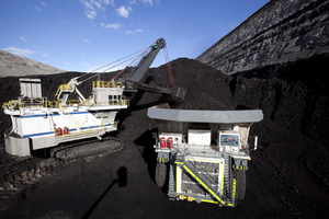
التعدين أهم مصدر للدخل، وأهم المنتجات المعدنية للولاية النفط والفحم الحجري والغاز الطبيعي. وتوجد عدة أماكن لهذه المنتجات المعدنية في أجزاء كبيرة من الولاية. وتوظف الحكومة والتجار كثيرًا من الناس في ويومينج. وتتضمن الأنشطة الحكومية إدارة المؤسسات العسكرية. وتعتبر تربية الأبقار النشاط الزراعي الرئيسي في ويومينج.
إنتاج المعادن والطاقة
Wyoming's mineral commodities include coal, natural gas, coalbed methane, crude oil, uranium, and trona.
- Coal: Wyoming produced 277 million short tons (251.29 million metric tons) of coal in 2019 which was a 9 percent drop from the year before.[63] Wyoming's coal production peaked in 2008 when 514 million short tons (466.3 million metric tons) was produced.[63] Wyoming possesses a reserve of 68.7 billion tons (62.3 billion metric tons) of coal. Major coal areas include the Powder River Basin and the Green River Basin.
- Coalbed methane (CBM): The boom for CBM began in the mid-1990s. CBM is characterized as methane gas that is extracted from Wyoming's coal bed seams. It is another means of natural gas production. There has been substantial CBM production in the Powder River Basin. In 2002, the CBM production yield was 327.5 billion cubic feet (9.3 km3).
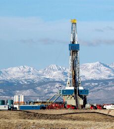
- Crude oil: Wyoming produced 53.4 مليون برميل (8.49×10⁶ m3) of crude oil in 2007. The state ranked fifth nationwide in oil production in 2007.[64] Petroleum is most often used as a motor fuel, but it is also utilized in the manufacture of plastics, paints, and synthetic rubber.
- Diamonds: The Kelsey Lake Diamond Mine, located in Colorado less than 1،000 أقدام (300 m) from the Wyoming border, produced gem quality diamonds for several years. The Wyoming craton, which hosts the kimberlite volcanic pipes that were mined, underlies most of Wyoming.
- Natural gas: Wyoming produced 1.77 trillion cubic feet (50.0 billion m3) of natural gas in 2016. The state ranked 6th nationwide for natural gas production in 2016.[65] The major markets for natural gas include industrial, commercial, and domestic heating.
- Trona: Wyoming possesses the world's largest known reserve of trona,[66] a mineral used for manufacturing glass, paper, soaps, baking soda, water softeners, and pharmaceuticals. In 2008, Wyoming produced 46 million short tons (41.7 million metric tons) of trona, 25% of the world's production.[66]
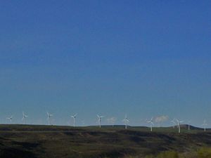
- Wind power: Because of Wyoming's geography and high-altitude, the potential for wind power in Wyoming is one of the highest of any state in the US. The Chokecherry and Sierra Madre Wind Energy Project is the largest commercial wind generation facility under development in North America.[67] Carbon County is home to the largest proposed wind farm in the US. Construction plans have been halted because of proposed new taxes on wind power energy production.[68]
- Uranium: Although uranium mining in Wyoming is much less active than it was in previous decades, recent increases in the price of uranium have generated new interest in uranium prospecting and mining.
الضرائب
النقل
Wyoming's largest airport is Jackson Hole Airport, with more than 500 employees.[69] Three interstate highways and 13 U.S. highways pass through Wyoming. The Wyoming state highway system also serves the state.
Interstate 25 enters Wyoming south of Cheyenne and runs north, intersecting Interstate 80 immediately west of Cheyenne. It passes through Casper and ends at Interstate 90, near Buffalo. Interstate 80 crosses the Utah border west of Evanston and runs east through the southern third of the state, passing through Cheyenne before entering Nebraska near Pine Bluffs. Interstate 90 comes into Wyoming near Parkman and cuts through the northeastern part of the state. It serves Gillette and enters South Dakota east of Sundance.
U.S. Routes 14, 16, and the eastern section of U.S. 20 have their western terminus at the eastern entrance to Yellowstone National Park and pass through Cody. U.S. 14 runs eastward before joining I-90 at Gillette. U.S. 14 then follows I-90 to the South Dakota border. U.S. 16 and 20 split off of U.S. 14 at Greybull and U.S. 16 turns east at Worland while U.S. 20 continues south Shoshoni. U.S. Route 287 runs from Fort Collins, Colorado, to Laramie, Wyoming, through a pass between the Laramie Mountains and the Medicine Bow Mountains, then merges with US 30 and I-80 until it reaches Rawlins, where it continues north, passing Lander. Outside of Moran, U.S. 287 is part of a large interchange with U.S. Highways 26, 191, and 89, before continuing north to Yellowstone's southern entrance. U.S. 287 continues north of Yellowstone, but the park separates the two sections.
Other U.S. highways that pass through Wyoming are 18, 26, 30, 85, 87, 89, 189, 191, 212, and 287.
Wyoming is one of only two states (the other is South Dakota) in the 48 contiguous states not served by Amtrak.[70] It was once served by Amtrak's San Francisco Zephyr and Pioneer lines.[71] While no passenger trains roll through Wyoming today, intercity buses continue to connect residents across the state. Intercity bus carriers in the state include Express Arrow, Greyhound Lines, and Jefferson Lines.[72][73][74]
| خريطة النفل المحلي |
|---|
Local Transit Systems (Only systems with fixed-route services are shown) |
Major interstates
- Invalid type: I (300.5 mi) connects Denver, Cheyenne, Casper and Buffalo. Most of the highway is connected with US 87. Major junctions include Interstate 80, US 30, US 85, US 26, US Routes 18 & 20 and US 16 before its northern terminus at Interstate 90 in Buffalo.
- Invalid type: I (402.8 mi) connects Evanston, Rock Springs, Rawlins, Laramie and Cheyenne. Major junctions include US 191, US 287, I-25, and US 85 & I-180.
- Invalid type: I (208.8 mi) connects Sheridan, Buffalo and Gillette. Primarily in northeastern Wyoming. Major junctions include US 14, I-25 and US 16.
Wind River Indian Reservation
The Eastern Shoshone and Northern Arapaho tribes share the Wind River Indian Reservation in central western Wyoming, near Lander. The reservation is home to 2,500 Eastern Shoshone and 5,000 Northern Arapaho.[75]
Chief Washakie established the reservation in 1868[76] as the result of negotiations with the federal government in the Fort Bridger Treaty,[77] but the federal government forced the Northern Arapaho onto the Shoshone reservation in 1876 after it failed to provide a promised separate reservation.[77]
Today the Wind River Indian Reservation is jointly owned, with each tribe having a 50% interest in the land, water, and other natural resources.[78] It is a sovereign, self-governed land with two independent governing bodies: the Eastern Shoshone Tribe and the Northern Arapaho Tribe. Until 2014, the Shoshone Business Council and Northern Arapaho Business Council met jointly as the Joint Business Council to decide matters that affect both tribes.[76] Six elected council members from each tribe served on the joint council.
الأراضي العامة
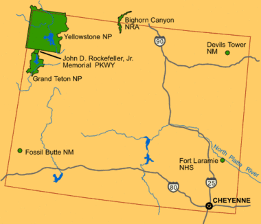
The federal government owns nearly half of Wyoming's land (about 30،099،430 acre (121،808.1 km2)); the state owns another 3،864،800 acre (15،640 km2).[79] Most of it is administered by the Bureau of Land Management and U.S. Forest Service in numerous national forests and a national grassland, not to mention vast swaths of "public" land and an air force base near Cheyenne.
There are also areas managed by the National Park Service and agencies such as the U.S. Fish and Wildlife Service.
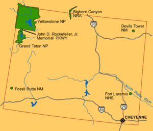
- المنتزهات الوطنية
- Grand Teton National Park
- Yellowstone National Park—first designated national park in the world[80]
- الطريق التذكاري
- The John D. Rockefeller Jr. Memorial Parkway connects Yellowstone and Grand Teton.
- National recreation areas
- Bighorn Canyon National Recreation Area
- Flaming Gorge National Recreation Area (managed by the Forest Service as part of Ashley National Forest)
- الصروح الوطنية
- Devils Tower National Monument—first national monument in the U.S.[80]
- Fossil Butte National Monument
- المدقات والمعالم والمواقع التاريخية الوطنية
- California National Historic Trail
- Fort Laramie National Historic Site
- Independence Rock National Historic Landmark
- Medicine Wheel/Medicine Mountain National Historic Landmark
- Mormon Pioneer National Historic Trail
- National Register of Historic Places listings in Wyoming
- Oregon National Historic Trail
- Pony Express National Historic Trail
- مفارخ الأسماك الوطنية
- National wildlife refuges
التعليم
The state superintendent of public instruction, an elected state official, directs public education. The State Board of Education, a nine-member board appointed by the governor, sets educational policy. The constitution prohibits the state from establishing curriculum and textbook selections; these are the prerogative of local school boards. The Wyoming School for the Deaf was the only in-state school dedicated to supporting deaf students before it closed in the summer of 2000.[81]
التعليم العالي
توجد في وايومنغ جامعة حكومية واحدة هي جامعة وايومنغ University of Wyomingوهي الجامعة الوحيدة التي تقدم درجات البكلريوس وما فوق. و مقر الجامعة الرئيسي هو مدينة لارامي. أفتتحت الجامعة في السادس من سبتمبر عام 1887. وحاليا يوجد في الجامعة اكثر من 13000 طالب في اكثر من 180 تخصص. لدى الجامعة فروع في مدينة كاسبر ونحو 9 كليات مجتمع في مدن وايومنغ المختلفة.
Wyoming has a public four-year institution, the University of Wyoming in Laramie, and a private four-year college, Wyoming Catholic College, in Lander. There are also seven two-year community colleges.
Before the passing of a new law in 2006, Wyoming had hosted unaccredited institutions, many of them suspected diploma mills.[82] The 2006 law requires unaccredited institutions to make one of three choices: move out of Wyoming, close down, or apply for accreditation. The Oregon State Office of Degree Authorization predicted in 2007 that in a few years the problem of diploma mills in Wyoming might be resolved.[83]
الإعلام
Wyoming's media market consists of 16 broadcast TV stations, radio stations and dozens of small to medium-sized newspapers.[84][85][86] There are also a few small independent news sources such as the nonprofit news site Wyofile.com[87] and Oil City News.[88]
قانون الدولة والحكومة
النظام القضائي
التاريخ السياسي
| الحزب | عدد المصوتين | النسبة | |
|---|---|---|---|
| Republican | 212,274 | 77.23% | |
| Democratic | 31,887 | 11.60% | |
| Unaffiliated | 25,954 | 9.44% | |
| Libertarian | 1,799 | 0.65% | |
| Constitution | 553 | 0.20% | |
| Other/No labels | 2,379 | 0.86% | |
| Total | 274,846 | 100.00% | |
Wyoming's political history defies easy classification. The state was the first to grant women the right to vote and to elect a woman governor.[90] On December 10, 1869, John Allen Campbell, the first Governor of the Wyoming Territory, approved the first law in United States history explicitly granting women the right to vote. This day was later commemorated as Wyoming Day.[90] On November 5, 1889, voters approved the first constitution in the world granting full voting rights to women.[90]
While the state elected notable Democrats to federal office in the 1960s and 1970s, politics have become decidedly more conservative since the 1980s as the Republican Party came to dominate the state's congressional delegation. Today, Wyoming is represented in Washington by its two Senators, John Barrasso and Cynthia Lummis, and its one member of the House of Representatives, Congresswoman Harriet Hageman. All three are Republicans; a Democrat has not represented Wyoming in the Senate since 1977 or in the House since 1978. The state has not voted for a Democrat for president since 1964, one of only eight times since statehood. In the 2004 presidential election, George W. Bush won his second-largest victory, with 69% of the vote. Former Vice President Dick Cheney is a Wyoming resident and represented the state in Congress from 1979 to 1989.
The last time a Democrat won a statewide election in Wyoming was in 2006, when Democratic governor Dave Freudenthal was re-elected to a second term by a wide margin, winning every county in the state. For 19 of Wyoming's 23 counties, 2006 marked the last time that they voted for the Democratic nominee in a statewide race. Of the remaining 4, Sweetwater County last voted Democratic in the 2008 U.S. House race and Laramie County last voted Democratic in the 2014 Superintendent of Public Instruction race, leaving Teton and Albany as the only counties that Democrats are able to win. Teton, which is composed of affluent resort communities, is reliably Democratic, except in Republican landslides like the 2022 gubernatorial election; Albany, which contains the college town of Laramie, is more competitive.
Republicans are dominant at the state level. They have held a majority in the state senate continuously since 1936 and in the state house since 1964, though Democrats held the governorship for all but eight years between 1975 and 2011. Uniquely, Wyoming elected Democrat Nellie Tayloe Ross as the first woman in United States history to serve as state governor. She served from 1925 to 1927, winning a special election after her husband, William Bradford Ross, unexpectedly died a little more than a year into his term.[91]
Wyoming retains the death penalty. Authorized methods of execution include the gas chamber.[92]
المقاطعات
The State of Wyoming has 23 counties.
| Wyoming Counties Ranked By 2005 Population[93] | |||||
|---|---|---|---|---|---|
| الترتيب | المقاطعة | التعداد | الترتيب | المقاطعة | التعداد |
| 1 | Laramie County | 85,163 | 13 | Converse County | 12,766 |
| 2 | Natrona County | 69,799 | 14 | Goshen County | 12,243 |
| 3 | Sweetwater County | 37,975 | 15 | Big Horn County | 11,333 |
| 4 | Campbell County | 37,405 | 16 | Platte County | 8,619 |
| 5 | Fremont County | 36,491 | 17 | Washakie County | 7,933 |
| 6 | Albany County | 30,890 | 18 | Johnson County | 7,721 |
| 7 | Sheridan County | 27,389 | 19 | Sublette County | 6,926 |
| 8 | Park County | 26,664 | 20 | Weston County | 6,671 |
| 9 | Uinta County | 19,939 | 21 | Crook County | 6,182 |
| 10 | Teton County | 19,032 | 22 | Hot Springs County | 4,537 |
| 11 | Lincoln County | 15,999 | 23 | Niobrara County | 2,286 |
| 12 | Carbon County | 15,331 | Wyoming Total | 509,294 | |
| Number on License Plate |
County | Number on License Plate |
County | Number on License Plate |
County |
|---|---|---|---|---|---|
| 1 | Natrona | 9 | Big Horn | 17 | Campbell |
| 2 | Laramie | 10 | Fremont | 18 | Crook |
| 3 | Sheridan | 11 | Park | 19 | Uinta |
| 4 | Sweetwater | 12 | Lincoln | 20 | Washakie |
| 5 | Albany | 13 | Converse | 21 | Weston |
| 6 | Carbon | 14 | Niobrara | 22 | Teton |
| 7 | Goshen | 15 | Hot Springs | 23 | Sublette |
| 8 | Platte | 16 | Johnson |
المدن والبلدات
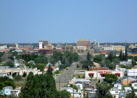
| الترتيب | المدينة | المقاطعة | التعداد |
|---|---|---|---|
| 1 | مدينة شايان | مقاطعة لارامي | 55,731 |
| 2 | مدينة وايومنگ | مقاطعة ناترونا | 51,738 |
| 3 | مدينة لارامي | مقاطعة ألباني | 26,050 |
| 4 | مدينة جيلت | مقاطعة كامبل | 22,685 |
| 5 | مدينة روك سپرنگز | مقاطعة سويتواتر | 18,772 |
| 6 | مدينة شريدان | مقاطعة شريدان | 16,333 |
| 7 | City of Green River | Sweetwater County | 11,787 |
| 8 | City of Evanston | Uinta County | 11,459 |
| 9 | City of Riverton | Fremont County | 9,430 |
| 10 | City of Cody | Park County | 9,100 |
| 11 | Town of Jackson | Teton County | 9,038 |
| 12 | City of Rawlins | Carbon County | 8,658 |
| 13 | City of Lander | Fremont County | 6,898 |
| 14 | City of Douglas | Converse County | 5,581 |
| 15 | City of Torrington | Goshen County | 5,533 |
| 16 | City of Powell | Park County | 5,288 |
| 17 | City of Worland | Washakie County | 4,967 |
| 18 | مدينة بفلو | مقاطعة جونسون | 4,290 |
| 19 | Town of Wheatland | Platte County | 3,464 |
| 20 | City of Newcastle | Weston County | 3,221 |
المناطق الحضرية
| منطقة التعداد | المقاطعة | التعداد |
|---|---|---|
| Cheyenne, WY, Metropolitan Statistical Area | Laramie County, Wyoming | 85,163 |
| Casper, WY, Metropolitan Statistical Area | Natrona County, Wyoming | 69,799 |
| Rock Springs, WY, Micropolitan Statistical Area | Sweetwater County, Wyoming | 37,975 |
| Gillette, WY, Micropolitan Statistical Area | Campbell County, Wyoming | 37,405 |
| Riverton, WY, Micropolitan Statistical Area | Fremont County, Wyoming | 36,491 |
| Laramie, WY, Micropolitan Statistical Area | Albany County, Wyoming | 30,890 |
| Sheridan, WY, Micropolitan Statistical Area | Sheridan County, Wyoming | 27,389 |
| Jackson, WY-ID, Micropolitan Statistical Area | Teton County, Wyoming | 19,032 |
| Teton County, Idaho | 7,467 | |
| Total | 26,499 | |
| Evanston, WY, Micropolitan Statistical Area | Uinta County, Wyoming | 19,939 |
الثقافة
الرياضة
Due to its sparse population, Wyoming lacks any major professional sports teams; the Gillette Mustangs, an indoor football team based in Gillette that began play in 2021 prior to their departure from the city in 2023, were previously the only professional team in the state. However, the Wyoming Cowboys and Cowgirls—particularly the football and basketball teams—are quite popular; their stadiums in Laramie are about 7،200 أقدام (2،200 m) above sea level, the highest in NCAA Division I. The Wyoming High School Activities Association also sponsors twelve sports and there are three junior ice hockey teams, all of which are members of the NA3HL. Casper has hosted the College National Finals Rodeo since 2001.
رموز الولاية
List of all Wyoming state symbols:[1]
- State bird: western meadowlark (Sturnella neglecta)
- State coin: Sacagawea dollar
- State dinosaur: Triceratops
- State emblem: Bucking Horse and Rider
- State fish: cutthroat trout (Oncorhynchus clarki)
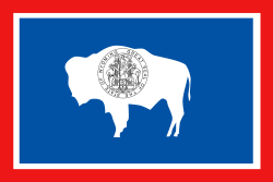
- State flag: Flag of the State of Wyoming
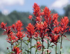
- State flower: Wyoming Indian paintbrush (Castilleja linariifolia)
- State fossil: Knightia
- State gemstone: Wyoming nephrite jade
- State grass: western wheatgrass (Pascopyrum smithii)
- State insect: Sheridan's green hairstreak butterfly (Callophrys sheridanii)
- State mammal: American bison (Bison bison)
- State motto: Equal Rights
- State nicknames: Equality State; Cowboy State; Big Wyoming
- State reptile: horned lizard (Phrynosoma douglassi brevirostre)
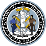
- State seal: Great Seal of the State of Wyoming
- State song: "Wyoming" by Charles E. Winter & George E. Knapp
- State sport: rodeo
- State tree: plains cottonwood (Populus sargentii)
ملاحظات
أنظر أيضا
المصادر
- ^ أ ب ت ث ج ح خ "Wyoming Facts and Symbols". State of Wyoming. 2013. Archived from the original on September 20, 2016. Retrieved October 12, 2016. خطأ استشهاد: وسم
<ref>غير صالح؛ الاسم "WyoFacts" معرف أكثر من مرة بمحتويات مختلفة. - ^ "Gannett Peak Cairn". NGS data sheet. U.S. National Geodetic Survey. Retrieved October 24, 2011.
- ^ أ ب "Elevations and Distances in the United States". United States Geological Survey. 2001. Archived from the original on July 22, 2012. Retrieved October 24, 2011.
- ^ أ ب Elevation adjusted to North American Vertical Datum of 1988.
- ^ "Median Annual Household Income". The US Census Bureau. Archived from the original on December 20, 2016. Retrieved December 9, 2016.
- ^ "Trails across Wyoming: The Oregon, Mormon Pioneer and California Routes | WyoHistory.org". www.wyohistory.org. Retrieved 2024-01-05.
- ^ "Industry, Politics and Power: the Union Pacific in Wyoming | WyoHistory.org". www.wyohistory.org. Retrieved 2024-01-05.
- ^ "Cheyenne, Magic City of the Plains | WyoHistory.org". www.wyohistory.org. Retrieved 2024-01-05.
- ^ "Dave Leip's Atlas of U.S. Presidential Elections". Archived from the original on July 9, 2018. Retrieved November 18, 2016.
- ^ Bright, William (2004). Native American Place Names of the United States. Norman: University of Oklahoma Press, pg. 576
- ^ State of Wyoming—Narrative Archived مايو 15, 2008 at the Wayback Machine
- ^ "Women's History Collections". American Heritage Center. Retrieved April 14, 2023.
- ^ Helton, Jennifer (August 14, 2020). "How the American West Led the Way for Women in Politics". Smithsonian. Retrieved April 14, 2023.
- ^ Larson, T. A. (1990). History of Wyoming. University of Nebraska Press. ISBN 978-0-803-27936-0.
- ^ Sodaro, Craig; Adams, Randy (1996). Frontier Spirit: The Story of Wyoming. Johnson Books. pp. 136–39. ISBN 978-1-55566-163-2.
- ^ "The Climate of Wyoming". Wyoming State Climate Office and Water Resources Data System. Retrieved April 14, 2023.
- ^ "Weather". U.S. National Park Service. Retrieved April 14, 2023.
- ^ http://countrystudies.us/united-states/weather/wyoming/casper.htm
- ^ http://countrystudies.us/united-states/weather/wyoming/jackson.htm
- ^ Willam J. Gribb; Lawrence M. Ostrech. "Databases and Algorithms to Determine the Boundary of Wyoming" (PDF). University of Wyoming, Department of Geography. Archived from the original (PDF) on ديسمبر 17, 2008. Retrieved ديسمبر 14, 2008.
- ^ Ivars Peterson. "Rectangular States and Kinky Borders". Archived from the original on July 5, 2008. Retrieved December 14, 2008.
- ^ أ ب "Wyoming Basins Ecoregion". Landscope. June 26, 2012. Archived from the original on February 26, 2020. Retrieved March 11, 2021.
- ^ "Level III Ecoregions of the Continental United States". hort.purdue.edu. Purdue University. April 1, 2000. Archived from the original on February 11, 2021. Retrieved March 9, 2021.
- ^ "Wyoming Eco-Regions" (PDF). EPA. Jan 1, 2004. Archived from the original (PDF) on 2022-05-09. Retrieved March 9, 2021.
- ^ أ ب "U.S. Census Bureau QuickFacts". United States Census Bureau. Retrieved April 18, 2024.
- ^ "Historical decennial census population for Wyoming counties, cities, and towns". U.S. Census, State of Wyoming. Archived from the original on July 8, 2017. Retrieved September 24, 2012.
- ^ "TetonAT.com—Interesting Wyoming License Plate Fact". Tetonat.com. Archived from the original on September 4, 2017. Retrieved September 4, 2017.
- ^ "Annual Estimates of the Resident Population for Counties: April 1, 2020 to July 1, 2024". United States Census Bureau. Retrieved December 26, 2024.
- ^ "Historical Population Change Data (1910–2020)". Census.gov. United States Census Bureau. Archived from the original on April 29, 2021. Retrieved May 1, 2021.
- ^ "2020 Census" (PDF). Census Bureau. April 26, 2021. Archived (PDF) from the original on April 26, 2021. Retrieved July 12, 2021.
- ^ "State & County QuickFacts". U.S. Census Bureau. 2013. Archived from the original on يوليو 3, 2011. Retrieved مايو 6, 2013.
- ^ "Centers of Population by State". U.S. Census Bureau. 2013. Archived from the original on يناير 3, 2014. Retrieved مايو 9, 2013.
- ^ "2007-2022 PIT Counts by State".
- ^ "The 2022 Annual Homelessness Assessment Report (AHAR) to Congress" (PDF).
- ^ "Profile of General Population and Housing Characteristics: 2020 Demographic Profile Data (DP-1): Wyoming". United States Census Bureau. Retrieved April 19, 2024.
- ^ Exner, Rich (June 3, 2012). "Americans under age 1 now mostly minorities, but not in Ohio: Statistical Snapshot". The Plain Dealer. Archived from the original on July 14, 2016. Retrieved August 16, 2012.
- ^ "These Visualizations Break Down America's Huge Racial Wealth Gap". HowMuch. Archived from the original on March 8, 2022. Retrieved 2022-03-08.
- ^ "Hispanics fastest growing ethnic group in Wyoming". Billings Gazette via AP. مايو 21, 2007. Archived from the original on يوليو 21, 2012. Retrieved مايو 7, 2008.
- ^ AP (2016-12-22). "Wyoming population drops, but there are positive signs in economy". Wyoming News Now (in الإنجليزية). Retrieved 2025-03-09.
- ^ Brittingham, Angela; de la Cruz, G. Patricia (June 2004). "Ancestry: 2000, Census 2000 Brief" (PDF). Census.gov. Retrieved May 7, 2025.
- ^ "Immigrants in Wyoming". June 2015.
- ^ "Births: Final Data for 2013" (PDF). Cdc.gov. Archived (PDF) from the original on September 11, 2017. Retrieved 4 September 2017.
- ^ "Births: Final Data for 2014" (PDF). Cdc.gov. Archived (PDF) from the original on February 14, 2017. Retrieved 4 September 2017.
- ^ "Births: Final Data for 2015" (PDF). Cdc.gov. Archived (PDF) from the original on August 31, 2017. Retrieved 4 September 2017.
- ^ "data" (PDF). Centers for Disease Control and Prevention. Archived (PDF) from the original on June 3, 2018. Retrieved May 7, 2018.
- ^ "Births: Final Data for 2017" (PDF). Archived (PDF) from the original on February 1, 2019. Retrieved February 22, 2019.
- ^ "Data" (PDF). Centers for Disease Control and Prevention. Archived (PDF) from the original on November 28, 2019. Retrieved December 21, 2019.
- ^ "Data" (PDF). Centers for Disease Control and Prevention. Archived (PDF) from the original on June 23, 2021. Retrieved April 9, 2021.
- ^ "Data" (PDF). Centers for Disease Control and Prevention. Archived (PDF) from the original on February 10, 2022. Retrieved 2022-02-21.
- ^ "Data" (PDF). Centers for Disease Control and Prevention. Retrieved 2022-02-03.
- ^ "Data" (PDF). www.cdc.gov. Retrieved 2024-04-05.
- ^ "Data" (PDF). www.cdc.gov. Retrieved 2025-04-12.
- ^ "Most Spoken Languages in Wyoming in 2010". Modern Language Association. Archived from the original on يونيو 19, 2006. Retrieved ديسمبر 15, 2013.
- ^ Hyon B. Shin; Robert A. Kominski (April 2010). "Language Use in the United States: 2007" (PDF). United States Census Bureau. United States Department of Commerce. Archived (PDF) from the original on June 14, 2013. Retrieved May 27, 2013.
- ^ Staff (February 24, 2023). "2020 American Values Atlas: Religious Tradition". Public Religion Research Institute. Retrieved April 15, 2023.
- ^ "PRRI – American Values Atlas". ava.prri.org. Retrieved 2022-09-17.
- ^ أ ب "Religion in America: U.S. Religious Data, Demographics and Statistics—Pew Research Center". Archived from the original on December 2, 2017. Retrieved December 3, 2017.
- ^ "Mississippi and Alabama Most Protestant States in U.S." Gallup. February 5, 2014. Archived from the original on April 14, 2016. Retrieved June 4, 2014.
- ^ "State Membership Report: Wyoming". Association of Religion Data Archives. Archived from the original on December 15, 2013. Retrieved December 15, 2013.
- ^ "Maps and data files for 2020 | U.S. Religion Census | Religious Statistics & Demographics". www.usreligioncensus.org. Retrieved 2022-12-10.
- ^ "Why Christians don't go to church anymore (and why they must)". National Christian Foundation (in الإنجليزية الأمريكية). October 18, 2018. Retrieved 2023-04-15.
- ^ Praveen Duddu (October 20, 2013). "The 10 biggest coal mines in the world" Archived أكتوبر 31, 2018 at the Wayback Machine. mining-technology.com. Verdict Media Limited. Retrieved October 31, 2018.
- ^ أ ب "Coal Production & Mining". Oct 1, 2020. Archived from the original on March 7, 2020. Retrieved March 12, 2021.
- ^ خطأ استشهاد: وسم
<ref>غير صحيح؛ لا نص تم توفيره للمراجع المسماةpetro - ^ US Energy Information Administration, Natural Gas Production Archived يونيو 23, 2017 at the Wayback Machine, accessed 14 June 2017.
- ^ أ ب Gearino, Jeff (February 16, 2009). "Soda ash companies enjoy record year". Casper Star Tribune. Archived from the original on January 12, 2013.
- ^ "Power Company of Wyoming: Chokecherry and Sierra Madre Wind Energy Project". Powercompanyofwyoming.com. Archived from the original on September 4, 2017. Retrieved September 4, 2017.
- ^ Paterson, Leigh (June 14, 2016). "Construction of Largest U.S. Wind Farm Is on Hold". wyomingpublicmedia.org. Archived from the original on June 18, 2016. Retrieved 21 June 2016.
- ^ "Airport Improvement Projects—Jackson Hole Airport (JAC), Jackson Hole, Wyoming". Jacksonholeairport.com. Archived from the original on يناير 13, 2012. Retrieved سبتمبر 4, 2017.
- ^ "Amtrak National Facts". Amtrak.com. Archived from the original on مارس 10, 2016. Retrieved مارس 18, 2016.
- ^ "Last passenger trains rolling across Wyoming". Spokesman-Review. July 13, 1983. Archived from the original on June 4, 2021. Retrieved September 12, 2010.
- ^ "Greyhound and connecting partners map". Retrieved June 29, 2022.
- ^ "Express Arrow Locations". Retrieved June 29, 2022.
- ^ "Bus tickets to Wyoming". Retrieved June 29, 2022.
- ^ "Wind River Country: Wind River Indian Reservation". Archived from the original on مارس 19, 2009.
- ^ أ ب Background of Wind River Reservation Archived فبراير 27, 2009 at the Wayback Machine
- ^ أ ب "Chiefe: The Rez". PBS. Archived from the original on February 28, 2013. Retrieved September 18, 2017. PBS. Independent Lens
- ^ "Background—Northern Arapaho Tribe". Northernarapaho.com. Archived from the original on September 15, 2017. Retrieved September 4, 2017.
- ^ MainEnvironment.org Archived مايو 25, 2017 at the Wayback Machine Public Land Ownership by State, 1995 Main Environment.org
- ^ أ ب "Listing of National Park System Areas by State". National Park Service. Archived from the original on June 29, 2011. Retrieved June 30, 2011.
- ^ Watt, Meghan (October 1, 2007). "Deaf alumni saddened by school's fate". Casper Star-Tribune (in الإنجليزية). Archived from the original on December 5, 2017. Retrieved 2017-04-08.
- ^ Alleged "diploma mills" flocking to Wyoming Archived ديسمبر 23, 2007 at the Wayback Machine, by Mead Gruver, The Seattle Times, February 9, 2005
- ^ Unaccredited Colleges Archived يوليو 15, 2007 at the Wayback Machine, Potential problems with degree suppliers located in these states—Wyoming, Oregon State Office of Degree Authorization
- ^ "Wyoming Newspapers Online". w3newspapers.com. January 17, 2021. Archived from the original on November 13, 2020. Retrieved January 17, 2021.
- ^ "Television Stations". stationindex.com. January 17, 2021. Archived from the original on May 27, 2018. Retrieved January 17, 2021.
- ^ "Radio Stations in Wyoming". radio-locator.com. January 17, 2021. Archived from the original on January 15, 2021. Retrieved January 17, 2021.
- ^ "About us". wyofile.com. Wyofile. January 17, 2021. Archived from the original on December 21, 2020. Retrieved January 17, 2021.
- ^ "About us". oilcity.news. Oil City News. January 17, 2021. Archived from the original on January 12, 2021. Retrieved January 17, 2021.
- ^ "Statewide Summary: Wyoming Voter Registration". Wyoming Secretary of State. March 1, 2023. Retrieved May 17, 2024.
- ^ أ ب ت "Today in History". The Library of Congress. Archived from the original on June 8, 2012. Retrieved July 20, 2012.
- ^ Teva J. Scheer (2005). Governor lady: the life and times of Nellie Tayloe Ross. Columbia: University of Missouri Press. p. 73. ISBN 978-0-8262-1626-7.
- ^ "Methods of Execution".
- ^ "Table 1: Annual Estimates of the Population for Counties of Wyoming: April 1, 2000 to July 1, 2005" (CSV). 2005 Population Estimates. U.S. Census Bureau, Population Division. 2006-03-16. Retrieved 2007-01-09.
- ^ "Table 4: Annual Estimates of the Population for Incorporated Places in Wyoming, Listed Alphabetically: April 1, 2000 to July 1, 2005" (CSV). 2005 Population Estimates. U.S. Census Bureau, Population Division. 2006-06-20. Retrieved 2007-01-09.
- ^ "CBSA-EST2005-alldata: Population Estimates and Estimated Components of Change for Metropolitan and Micropolitan Statistical Areas and Their Geographic Components: April 1, 2000 to July 1, 2005" (CSV). 2005 Population Estimates. U.S. Census Bureau, Population Division. 2006-08-18. Retrieved 2007-01-09.
الهامش
وصلات خارجية
![]() تعريفات قاموسية في ويكاموس
تعريفات قاموسية في ويكاموس
![]() كتب من معرفة الكتب
كتب من معرفة الكتب
![]() اقتباسات من معرفة الاقتباس
اقتباسات من معرفة الاقتباس
![]() نصوص مصدرية من معرفة المصادر
نصوص مصدرية من معرفة المصادر
![]() صور و ملفات صوتية من كومونز
صور و ملفات صوتية من كومونز
![]() أخبار من معرفة الأخبار.
أخبار من معرفة الأخبار.
- State Government
- State of Wyoming government website
- Official Wyoming State Travel Website - Forever West
- Wyoming Department of Transportation website
- State information and symbols
- U.S. Government
- Energy Data & Statistics for Wyoming- From the U.S. Department of Energy
- Wyoming State Law Library
- USGS real-time, geographic, and other scientific resources of Wyoming
- U.S. Census Bureau
- USDA Wyoming State Facts
- Other
- وايومنگ at the Open Directory Project
- Wyoming's portal to knowledge and learning
- Wyoming Ski and Snowboard Areas on SnowGuide.org
- Gertrude of Wyoming by Thomas Campbell
- Wyoming Travel Guide
- Short Documentary About Wyoming
- Free State Wyoming
- Maps of Wyoming from the University of Texas libraries

|
مونتانا | 
| ||
| جنوب داكوتا Nebraska |
أيداهو | |||
| كولورادو | يوتا |
| سبقه أيداهو |
قائمة الولايات الأمريكية حسب تاريخ الانضمام | تبعه يوتا |
43°00′N 107°30′W / 43°N 107.5°W
خطأ استشهاد: وسوم <ref> موجودة لمجموعة اسمها "lower-alpha"، ولكن لم يتم العثور على وسم <references group="lower-alpha"/>
- CS1 الإنجليزية الأمريكية-language sources (en-us)
- Pages using gadget WikiMiniAtlas
- Short description is different from Wikidata
- Pages using infobox settlement with possible nickname list
- Pages using infobox settlement with no coordinates
- Articles containing Munsee-language text
- Articles with hatnote templates targeting a nonexistent page
- Jct template errors
- مقالات فيها عبارات متقادمة منذ يونيو 2025
- جميع المقالات التي فيها عبارات متقادمة
- Pages with empty portal template
- Coordinates on Wikidata
- وايومنگ
- دول وأراضي تأسست في 1890
- ولايات أمريكية

