محافظة مرسين
محافظة مرسين
Mersin ili | |
|---|---|
تجمع سكاني | |
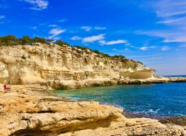 Mersin coastline | |
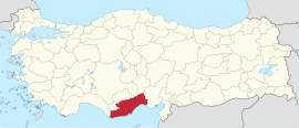 Location of the province within Turkey | |
| البلد | تركيا |
| المقر | مرسين |
| الحكومة | |
| المساحة | 16٬010 كم² (6٬180 ميل²) |
| التعداد (2022)[2] | 1٬916٬432 |
| • الكثافة | 120/km2 (310/sq mi) |
| منطقة التوقيت | TRT (UTC+3) |
| Area code | 0324 |
| الموقع الإلكتروني | www www |
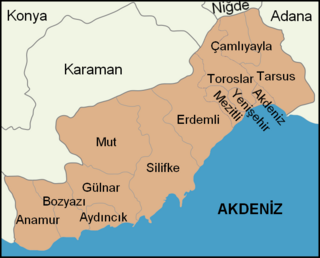
محافظة مرسين (تركية: Mersin ili وسابقاً محافظة إيتشيل İçel Province ؛ İçel ili)، هي إحدى محافظات تركيا، وتقع على ساحل البحر المتوسط بين محافظة أنطاليا وأضنة في جنوب تركيا. عاصمتها مدينة مرسين. Its area is 16,010 km2,[3] and its population is 1,916,432 (2022).[2] The provincial capital and the biggest city in the province is Mersin, which is composed of four municipalities and district governorates: Akdeniz, Mezitli, Toroslar and Yenişehir. Next largest is Tarsus, the birthplace of Paul the Apostle. The province is considered to be a part of the geographical, economical and cultural region of Çukurova, which covers the provinces of Mersin, Adana, Osmaniye and Hatay.
The capital of the province is the city of Mersin.
أصل الاسم
The province is named after its biggest city Mersin. Mersin was named after the aromatic plant genus Myrsine (Greek: Μυρσίνη, تركية: mersin) in the family Primulaceae, a myrtle that grows in abundance in the area. The 17th-century Ottoman traveler Evliya Çelebi has recorded in his Seyahatnâme that there was also a clan named Mersinoğulları in the area.[4]
الجغرافيا
Ninth biggest province of Turkey by land area, Mersin consists 2,02% of Turkey.[6] 87% of the land area is mountain, leading up to the rocky heights of the central Taurus Mountains, the highest peak is Medetsiz (3,584 m) in the Bolkar range, and there are a number of important passes over to central Anatolia. There are many high meadows and small plains between 700 and 1500m.
The coastal strip has many large areas of flatland, formed from soil brought down by rivers and streams running off the mountains. This is fertile land, the largest area being the plain of Tarsus. The largest rivers are the Göksu and the Berdan (Göksu Calycadnus and Berdan Cydnus of antiquity), but there are many small streams running into lakes, reservoirs or the Mediterranean sea. Mersin has 321 km of coastline, much of it sandy beach. The climate is typical of the Mediterranean; very hot and rainless in summer, mild and wet in winter. The winter rains can be very heavy and flooding is a problem in many areas, but it never snows on the coast, only in the mountainous areas.
تطل القلعة على ساحل المتوسط في 36°04′51″N 32°53′40″E / 36.08083°N 32.89444°E، على D400 highway, 6 كم شرق أنامور و 216 كم غرب مرسين.
السياحة
مواقع التراث العالمي
تحفل محافظة مرسين بعدد من مواقع التراث العالمي والإنساني لعدد من حضارات متنوعة تعد بمثابة متحف مفتوح تم تسجيلها في قائمة منظمة اليونسكو للتربية والعلوم والثقافة التابعة للأمم المتحدة، فضلا عن المعالم السياحية والشواطئ التي تشتهر بظهور أنواع نادرة من السلاحف حيث تنعم الولاية بدفء طوال أيام العام سوف نتعرض لقائمة التراث العالمي بتلك المدينة المفعمة بالحيوية:
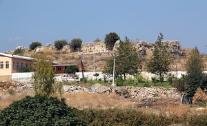
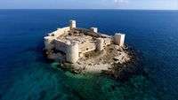
- مدينة كوركوس: الأثرية تضم المدينة عدد من الأماكن الأثرية مثل قلعة البنت وصخوم أدم ودير آلاهان وكنيسة القديس بولس وقلعة مامور تعد المدينة هي المدينة الأكثر أهمية بين كل المواقع الأثرية كانت المدينة من أهم موانئ البحر الأبيض المتوسط منذ عهد الحيثيين وحتى عهد الحضارات الهيلينستية والرومانية والبيزنطية تضم المدينة أهم المعالم التي يقصدها عدد هائل من السياح حول العالم منها قلعة البنت وصخور أدم التي تقشت عليها النقوش الكبيرة والأشكال بأحجام كبيرة في القرن الثالث قبل الميلاد حتى القرن الثالث الميلادي كان للمدينة أهمية كبيرة في عهد الرومان استخدمت موانئ المدينة في تصدير زيت الزيتون.
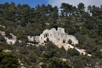
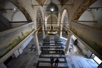
- قلعة آلاهان: يقع دير آلاهان في وادي گوكسو في منطقة موت بمدينة مرسين يقصده عدد من المهتمون بالشأن التاريخي والحضاري الثقافي بفضل الإطالة المميزة وأيضًا السياحة الطبيعة والإطلالات الطبيعة الخلابة تم بناء الدير في 440 إلى 442 ميلادية كتب عنه الرحالة العثماني أولياء جلبي يتكون الدير من كنسيتين واحدة منهم تهدمت يوجد عدد من المقابر طراز الدير على طراز أيا صوفيا يطلق عليه ايا صوفيا مرسين ويحتل هذا الدير أهمية كبيرة عند الحجاج المسحيين.
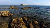
- قلعة مامور: يرجع تاريخها للعصور الوسطى احتلت القلعة موقعًا فريدًا مما جعلها تدخل في موسوعة التراث العالمي التابعة لليونسكو تمتد القلعة من 24ألف مترًا يجعلها واحدة من أكبر القلاع في تركيا تضم أثار رومانية وبيزنطية وسلجوقية وقرمانلية وعثمانية يوجد بالقلعة مسجد لا تزال تقيم بيه الصلاة إلى اليوم تقع القلعة على البحر المتوسط محاطة باللون الأزرق من جميع النواحي تقوم وزارة السياحة والثقافة بترميم القلعة لفتحها للزوار.
- كنيسة القديس بولس: من ضمن مواقع الآثار المدرجة على قائمة اليونسكو تقع في مدينة طرسوس شهدت مولد القديس بولص في العقيدة المسيحية هي الكنيسة الوحيدة التي تم المحافظة عليها، تجذب الكنيسة عدد من السياح من المهتمون بالتاريخ والآثار القبطية.
التاريخ
Designed to protect against pirates, it was repaired during the Byzantine era and during the Crusades. When Alaattin Keykubat I of Seljuk Turks captured the ruins of the castle in 1221, he built a larger castle using elements of the earlier fortifications. Later, it was controlled by the Karamanid dynasty (which was a Turkmen principality in Anatolia). Although the exact date is uncertain, according to an inscription by İbrahim II of Karaman in 1450, the castle was captured during Mahmut's reign (1300–1311). The castle was renamed as Mamure (prosperous) after repairs by Mahmut.[7] In 1469, the castle was annexed by the Ottoman Empire.[8] It was subsequently repaired in the 15th, 16th and 18th centuries and a part of the castle was used as a caravansarai.
المقاطعات
تنقسم محافظة مرسين إلى 13 مقاطعة:
- Akdeniz
- Mezitli
- Toroslar
- Yenişehir
- أنامور
- Aydıncık
- Bozyazı
- Çamlıyayla
- Erdemli
- گلنار
- موت
- سلوقيا قيليقيا
- طرطوس
سكان المحافظة
| المقاطعة | السكان (المنطقة الحضرية) |
السكان (إجمالي المقاطعة والمنطقة الريفية) |
|---|---|---|
| مرسين | 842,230 | 888,803 |
| أنامور | 34,227 | 62,702 |
| Aydıncık | 8,004 | 11,651 |
| Bozyazı | 15,615 | 26,295 |
| Çamlıyayla | 2,861 | 9,847 |
| Erdemli | 45,241 | 125,391 |
| گلنار | 8,357 | 19,141 |
| موت | 28,966 | 63,673 |
| Silifke | 51,684 | 113,404 |
| طرطوس | 233,436 | 308,681 |
أهم الأماكن
بلدات وتقسيمات جغرافية أخرى
الهوامش
- ^ "Belediye Başkanımız". Mersin Büyükşehir Belediyesi. Archived from the original on 2019-03-23. Retrieved 2022-05-12.
- ^ أ ب "Address-based population registration system (ADNKS) results dated 31 December 2022, Favorite Reports" (XLS) (in الإنجليزية). TÜİK. Retrieved 19 September 2023.
- ^ "İl ve İlçe Yüz ölçümleri". General Directorate of Mapping. Retrieved 19 September 2023.
- ^ İçel: Mersin- Tarsus- Çamlıyayla- Erdemli- Silifke- Aydıncık- Bozyazı- Anamur- Gülnar- Mut (Kültür, Turizm ve Tanıtım yayınları, 1992), p. 7.
- ^ "Present and future Köppen-Geiger climate classification maps at 1-km resolution". Nature Scientific Data. DOI:10.1038/sdata.2018.214.
- ^ "Mersin - Ansiklopedika Viki" (in التركية). 2022-03-22. Retrieved 2022-09-27.
- ^ "Mersin - Anamur - Mamure Kalesi".
- ^ "Anamur - Mamure Castle".
وصلات خارجية
- مدينة مرسين
- معلومات عن الطقس في مرسين
- عن مدينة مرسين
- جامعة مرسين
- مجلس مدينة مرسين
- أشخاص من مرسين
- Real Estate Agency Mersin Turkey
- some photographs of Mersin
- * Mersin technopark
- Mersin Chamber of Commerce and Industry (in English)
- Mersin Chamber of Shipping (in English)
- Mersin Photographic society (in English)
- 2008 Saint Paul Year English)
- Mersin News
- Mersin 2013 Web Site
- CS1 التركية-language sources (tr)
- Pages using gadget WikiMiniAtlas
- Short description matches Wikidata
- Short description is different from Wikidata
- Turkey articles requiring maintenance
- Pages using infobox settlement with no coordinates
- Pages using Lang-xx templates
- Articles containing Greek-language text
- Coordinates on Wikidata
- محافظات تركيا
- محافظة مرسين
- منطقة البحر المتوسط
