البويرة، إسبانيا
La Albuera | |
|---|---|
 | |
| الإحداثيات: 38°42′58″N 6°49′26″W / 38.71611°N 6.82389°W | |
| Country | |
| Autonomous community | |
| Province | Badajoz |
| Comarca | Tierra de Badajoz |
| Judicial district | Badajoz |
| الحكومة | |
| • Mayor | Manuel Antonio Díaz González (PSOE) |
| المساحة | |
| • الإجمالي | 26٫4 كم² (10٫2 ميل²) |
| المنسوب | 253 m (830 ft) |
| التعداد ()[1] | |
| صفة المواطن | Albuereños |
| منطقة التوقيت | UTC+1 (CET) |
| • الصيف (التوقيت الصيفي) | UTC+2 (CEST) |
| Postal code | 06170 |
| الموقع الإلكتروني | Official website |
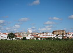
La Albuera is a village southeast of Badajoz, Extremadura, Spain. اعتبارا من 2009[تحديث] it had a population of c. 2,000 inhabitants.
التاريخ
It was scene of the Battle of Albuera (16 May 1811) between Spanish, Portuguese and British troops under William Carr Beresford and the French ones led by Marshal Soult, in the course of the Peninsular War.
الجغرافيا
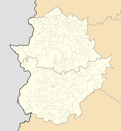
Located south of the city of Badajoz and next to the Spanish borders with Portugal, La Albuera is, along with Guadiana del Caudillo,[2] an enclave entirely surrounded by the municipal territory of Badajoz.[3][4]
Twin towns
 Descartes, France
See also
References
وصلات خارجية
 Media related to La Albuera at Wikimedia Commons
?
تصنيفات:
- CS1 errors: empty citation
- Short description is different from Wikidata
- Pages using gadget WikiMiniAtlas
- Pages using Template:Spain metadata Wikidata without references
- Official website different in Wikidata and Wikipedia
- مقالات فيها عبارات متقادمة منذ 2009
- جميع المقالات التي فيها عبارات متقادمة
- Municipalities in the Province of Badajoz
- Enclaves and exclaves

