باي ريدج، بروكلن
Bay Ridge
Yellow Hook | |
|---|---|
 | |
| الكنية: "The Ridge" | |
<mapframe> مشاكل:
الموقع في مدينة نيويورك | |
| الإحداثيات: 40°37′26″N 74°01′55″W / 40.624°N 74.032°W | |
| Country | |
| الولاية | |
| المدينة | |
| Borough | |
| Community District | Brooklyn 10[1] |
| الحكومة | |
| • Council Member | Justin Brannan |
| • New York State Senator | Andrew Gounardes |
| المساحة | |
| • الإجمالي | 2٫12 ميل² (5٫49 كم²) |
| • البر | 2٫12 ميل² (5٫49 كم²) |
| • الماء | 0 ميل² (0 كم²) |
| التعداد | |
| • الإجمالي | 79٬371 |
| • الكثافة | 37٬000/sq mi (14٬000/km2) |
| منطقة التوقيت | UTC−5 (Eastern) |
| • الصيف (التوقيت الصيفي) | UTC−4 (EDT) |
| ZIP Codes | 11209, 11220 |
| Area code | 718, 347, 929, and 917 |
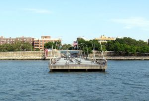
باي ريدج Bay Ridge، هي ضاحية في الركن الجنوبي الغربي من قسم بروكلين بمدينة نيويورك، الولايات المتحدة. تحدها صنست پارك، بروكلين، صنست پارك، من الشَمال، دايكر هايتس من الشرق، the Narrows and the Belt Parkway to the west, and Fort Hamilton Army Base وجسر ڤرازانو من الجنوب. المنطقة جنوب شارع 86 هي فورت هاميلتون ضاحية منفصلة، إلى أنها عادة ما تعتبر جزءاً من باي ريدج.
Bay Ridge was formerly the westernmost portion of the town of New Utrecht, comprising two smaller villages: Yellow Hook to the north and Fort Hamilton to the south. Yellow Hook was named for the color of the soil and was renamed Bay Ridge in December 1853 to avoid negative connotations with yellow fever at the time; the name Bay Ridge was chosen based on the local geography.[4] Bay Ridge became developed as a rural summer resort during the mid-19th century. The arrival of the New York City Subway's Fourth Avenue Line (present-day قالب:NYCS Fourth far south trains) in 1916 led to its development as a residential neighborhood. Bay Ridge is known for its historical Norwegian community and today its Irish, Italian, Arab and Greek communities, with smaller populations of Chinese, Russian, and Eastern Europeans.
فورت هاميلتون ومعظم باي ريدج يتشاركون الرمز البريدي 11209؛ الرمز البريدي للبقية 11200، حيث يقع مكتب بريد باي ريدج.[1] It is patrolled by the 68th Precinct of the New York City Police Department.[5] Politically, it is represented by the New York City Council's 43rd District.[6]
التاريخ
المستوطنات المبكرة
South Brooklyn was originally settled by the Canarsee Indians, one of several indigenous Lenape peoples who farmed and hunted on the land. Their main village in the area was Nyack. The Canarsee Indians had several routes that crossed Brooklyn, including a path from Fulton Ferry along the East River that extended southward to Gowanus Creek, Sunset Park, and Bay Ridge.[7][8] The Canarsee traded with other indigenous peoples, and by the early 17th century, also with Dutch and English settlers.[7]
The first European settlement at Bay Ridge occurred in 1636 when Willem Adriaenszen Bennett and Jacques Bentyn purchased 936 acre (379 ha) between 28th and 60th Streets, in what is now Sunset Park.[9][10][أ] However, after the land was purchased in the 1640s by Dutch settlers who laid out their farms along the waterfront, the Canarsee were soon displaced, and had left Brooklyn by the 18th century.[7] Present-day Bay Ridge was the westernmost portion of New Utrecht, founded in 1657 by the Dutch.[11][12] The area consisted of two sister villages: Yellow Hook to the north, named for the color of the soil, with "Hook" from the Dutch hoek, meaning "corner"[13] and Fort Hamilton to the south, named for the military installation at its center.[9][11]
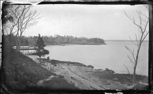
Yellow Hook was mostly farmland until the late 1840s. In 1848, Third Avenue within the area was widened. Two years later, a group of artists moved to the area and founded a colony called Ovington Village, named after the family who owned the farmland in the area.[14][15] Around 1853, Yellow Hook changed the community's name to avoid association with yellow fever.[16][17] "Bay Ridge" was suggested by local horticulturist James Weir after the area's most prominent geographic features: the high ridge that offered views of New York Bay.[18][19] The natural beauty attracted the wealthy, who built country homes along Shore Road, overlooking the water.[20]
The first settlers referred to Fort Hamilton as the Nyack Tract, after the Native American tribe that lived there.[9] Fort Hamilton began to develop in the 1830s as a resort destination when the corresponding military fortification was created. The mostly-immigrant laborers in the area started to create a community to the fort's north and west, which included stores, houses, churches, and a school. The community was linked by stagecoach to New Utrecht, Gowanus, and downtown Brooklyn, as well as by ferry to Staten Island and Manhattan.[21][22]
In the mid-19th century, a large number of country houses were built in Bay Ridge, especially along Shore Road, which faced the New York Harbor to the west.[9] The advent of the telephone allowed estate owners to communicate with their businesses in Manhattan while enjoying their stays at the elegant estates of Bay Ridge.[11][23] Through this period Greek Revival, Italianate, and Gothic Revival villas were built on Shore Road; many of these villas were constructed by the descendants of the area's original settlers.[11][21] Development in Bay Ridge continued through the 1890s.[24] One of the most prominent organizations in Bay Ridge was the Crescent Athletic Club, a football club built in 1884, which contained a summer clubhouse, boathouse, and playing fields.[11][14] By the late 19th century, it was anticipated that a series of parkways would be built across Brooklyn, connecting Bay Ridge to Eastern Parkway, Ocean Parkway, and Prospect Park. As such, several wide, tree-lined streets were laid through the neighborhood, including 75th Street (now Bay Ridge Parkway); Fort Hamilton Parkway; and Shore Road.[25][ب]
النمو السريع وإنشاء المترو
Until the late 19th century, Bay Ridge would remain a relatively isolated rural area,[21] reached primarily by stagecoaches, then by steam trolleys after 1878.[23] In 1892, the first electric trolley line was built in Brooklyn, starting at a ferry terminal at 39th Street and running via Second Avenue to 65th Street, and then via Third Avenue. The Fifth Avenue Elevated was then extended to Third Avenue and 65th Street.[23][26] This had the effect of raising land prices: one entity, the Bay Ridge Improvement Company, was able to buy land for $1،000 لكل acre ($2،500/ha) in 1890, and then sell land off for $1,000 per lot several years later.[23]
Real estate speculation commenced at the beginning of the 20th century.[27] A building boom in South Brooklyn started in about 1902 and 1903, and thousands of people started coming to the area from Manhattan and from other places.[26] The first definite plans for a Fourth Avenue subway (today's قالب:NYCS Fourth far south trains) were proposed by Rapid Transit Commission engineer William Barclay Parsons in 1903,[28] and two years later, a citizens' committee was created to aid the creation of the subway line.[29] The announcement of the subway line resulted in the immediate development of row houses in Bay Ridge.[28][30] In 1905 and 1906 realty values increased by about 100 percent, and land values increased due to the promise of improved transportation access.[26] Such was the rate of development, houses were being sold before they were even completed, and land prices could rise significantly just within several hours.[11]
The subway itself faced delays. In 1905, the Rapid Transit Commission adopted the Fourth Avenue route to Fort Hamilton; following approval by the Board of Estimate and mayor of New York City, the route was approved by the Appellate Division of the Supreme Court.[31][32][33] Bids for construction and operation were let,[31][32] but in 1907, the Rapid Transit Commission was succeeded by the Public Service Commission (PSC).[29] For much of 1908, there were legal disagreements about whether the project could be funded while remaining within the city's debt limit.[11] The PSC voted unanimously for the Fourth Avenue subway line in March 1908,[29][31] but the Board of Estimate did not approve contracts for the line until October 1909. By then, a non-partisan political body, with the backing of 25,000 South Brooklyn residents, was created that would only support candidates in the municipal election that pledged support for the Fourth Avenue subway.[31][34][35] Groundbreaking for the first section of the subway, between DeKalb Avenue and 43rd Street took place in 1909.[36] Not long after the contracts were awarded, the PSC started negotiating with the Brooklyn Rapid Transit Company and the Interborough Rapid Transit Company in the execution of the Dual Contracts, which were signed in 1913.[31] During the Dual System negotiations, the construction of an extension of the Fourth Avenue subway was recommended as part of the Dual System, which was approved in 1912.[31] Construction began on the sections between 61st–89th Streets and between 43rd–61st Streets in 1913, and was completed two years later.[33]
The line opened to 59th Street on June 21, 1915,[37] and was extended to 86th Street on January 15, 1916, at which time development started to accelerate.[38] At the time, Bay Ridge extended northward to what is now present-day Sunset Park.[39] Industrial developments were constructed along the waterfront north of present-day 65th Street, such as Bush Terminal (now Industry City), and those were considered to be within Bay Ridge.[40] By the 1920s, the number of apartment buildings had increased fivefold, replacing old farms, homesteads and houses.[41][42] Schools, churches, stores, movie theaters, and other structures were also created to serve the growing population.[23] The Fourth Avenue subway was extended further to Bay Ridge–95th Street in 1925,[43][44] by which point Bay Ridge's population had more than doubled since 1900.[41] By World War II, almost all of these large houses had been replaced with apartment buildings.[20]
In the nineteenth and early twentieth centuries, many Norwegian and Danish sailors emigrated to Brooklyn, including Bay Ridge and neighboring Sunset Park; Lapskaus Boulevard, referring to the salted Norwegian beef stew, is the nickname of Eighth Avenue in this area.[45]
الربط بستاتن آيلاند والسنوات اللاحقة
There had been plans to build the Staten Island Tunnel, a railroad or subway tunnel, from Bay Ridge to Staten Island as early as 1890.[46] By the 1910s, there were two proposals to build a tunnel splitting from the Fourth Avenue subway in Bay Ridge, either at Fort Hamilton or between 65th and 67th Streets.[47] The plan for the tunnel from 65th-67th Streets was ultimately selected[48] and work started in 1923, though the project was halted two years later.[49] In 1927, two years after the cancellation of the Staten Island Tunnel, engineer David B. Steinman brought up the possibility of constructing a vehicular bridge, the "Liberty Bridge", across the Narrows.[50][51] The tunnel proposal was also revived with the announcement of the Liberty Bridge, and proposals for vehicular and rail tunnels were both considered.[52][53] The bridge was disapproved by the United States Department of War in 1934,[54] and plans for a bridge were revived in 1936.[55] By the time the bridge was approved by the city's Board of Estimate in 1943, residents of Bay Ridge had turned against it, citing a detrimental impact to the neighborhood's character.[56]
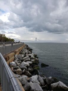
Robert Moses, the chairman of the Triborough Bridge and Tunnel Authority (TBTA), announced the revival of plans for what would become the Verrazzano-Narrows Bridge in 1947.[57] U.S. Representative Donald Lawrence O'Toole, whose constituency included Bay Ridge, opposed the proposal for the bridge in part because he believed it would damage the character of Bay Ridge.[58][59] The U.S. military approved the proposal anyway,[60][61] and in 1957, Moses proposed expanding Brooklyn's Gowanus Expressway and extending it to the Narrows Bridge by way of Seventh Avenue, which would require cutting through the middle of Bay Ridge. This proposal drew opposition from the community, who wanted the approach to follow the Belt Parkway along the Brooklyn shore.[62] After holding a hearing for concerned Bay Ridge residents, the Board of Estimate affirmed the Narrows Bridge plan in October 1958,[63] though this angered Bay Ridge residents since the construction of the approach would displace 7,500 people.[64] Also destroyed was Fort Lafayette, part of New York City's defense system along with Fort Hamilton and Fort Wadsworth in Staten Island; it was replaced by the base of the bridge's east tower.[65][66] The Verrazzano-Narrows Bridge opened in 1964.[67]
The 2007 Brooklyn tornado hit this area, specifically 68th Street and Bay Ridge Avenue between Third and Fourth Avenues.[68] Eleven houses had to be vacated after they suffered significant damage, and many of the trees on the two blocks toppled, landing on cars and stoops. The 4th Avenue Presbyterian Church had its very large stained glass window blown out.[69] As the tornado lifted, it peeled the roof of a nearby Nissan dealership and deforested 40% of Leif Ericson Park. The tornado has been rated EF2 on the Enhanced Fujita scale, with winds between 111 and 135 MPH.[70]
المناخ
تقع باي ريدج، بروكلن في أنماط مناخية مختلفة حسب نظام التصنيف المناخي المستخدم. However, the Köppen climate classification system is the most widely used climate classification scheme.
| باي ريدج، بروكلن | ||||||||||||||||||||||||||||||||||||||||||||||||||||||||||||
|---|---|---|---|---|---|---|---|---|---|---|---|---|---|---|---|---|---|---|---|---|---|---|---|---|---|---|---|---|---|---|---|---|---|---|---|---|---|---|---|---|---|---|---|---|---|---|---|---|---|---|---|---|---|---|---|---|---|---|---|---|
| جدول الطقس (التفسير) | ||||||||||||||||||||||||||||||||||||||||||||||||||||||||||||
| ||||||||||||||||||||||||||||||||||||||||||||||||||||||||||||
| ||||||||||||||||||||||||||||||||||||||||||||||||||||||||||||
| الشهر | ينا | فب | مار | أبر | ماي | يون | يول | أغس | سبت | أكت | نوف | ديس | السنة |
|---|---|---|---|---|---|---|---|---|---|---|---|---|---|
| القصوى القياسية °ف (°س) | 68 (20) |
77 (25) |
81 (27) |
90 (32) |
92 (33) |
96 (36) |
102 (39) |
95 (35) |
96 (36) |
92 (33) |
75 (24) |
71 (22) |
102 (39) |
| متوسط القصوى اليومية °ف (°س) | 37.2 (2.9) |
40.2 (4.6) |
48.3 (9.1) |
59.5 (15.3) |
69.7 (20.9) |
77.9 (25.5) |
84.0 (28.9) |
82.1 (27.8) |
75.9 (24.4) |
64.1 (17.8) |
52.1 (11.2) |
43.2 (6.2) |
61.2 (16.2) |
| المتوسط اليومي °ف (°س) | 34.1 (1.2) |
36.6 (2.6) |
43.7 (6.5) |
54.3 (12.4) |
64.6 (18.1) |
73.2 (22.9) |
79.4 (26.3) |
77.3 (25.2) |
71.0 (21.7) |
59.8 (15.4) |
48.7 (9.3) |
40.6 (4.8) |
56.9 (13.9) |
| متوسط الدنيا اليومية °ف (°س) | 31.0 (−0.6) |
33.0 (0.6) |
39.1 (3.9) |
49.0 (9.4) |
59.4 (15.2) |
68.4 (20.2) |
74.7 (23.7) |
72.4 (22.4) |
66.1 (18.9) |
55.4 (13.0) |
45.3 (7.4) |
38.0 (3.3) |
52.7 (11.5) |
| متوسط الدنيا °ف (°س) | 10.5 (−11.9) |
14.3 (−9.8) |
22.5 (−5.3) |
34.5 (1.4) |
46.2 (7.9) |
55.8 (13.2) |
65.1 (18.4) |
63.5 (17.5) |
53.7 (12.1) |
40.2 (4.6) |
28.9 (−1.7) |
22.4 (−5.3) |
8.6 (−13.0) |
| الصغرى القياسية °ف (°س) | 3 (−16) |
−1 (−18) |
14 (−10) |
27 (−3) |
35 (2) |
51 (11) |
61 (16) |
61 (16) |
49 (9) |
33 (1) |
16 (−9) |
13 (−11) |
−1 (−18) |
| [citation needed] | |||||||||||||
See or edit raw graph data.
التجمع
Bay Ridge is well known for its Norwegian community. By 1971, the 55,000-strong Norwegian community of Bay Ridge boasted that it was the fourth-largest Norwegian "city" in the world.[71] Residents also compared Eighth Avenue's string of Norwegian businesses to Oslo's Karl Johans gate.[71] The community continues to host the annual Norwegian Constitution Day Parade, also known as the Syttende Mai Parade, in which hundreds of people in folk dress proceed down Third Avenue. The celebration ends in Leif Ericson Park, where "Miss Norway" is crowned near the statue of Leif Ericson. The statue was donated by Crown Prince Olav, Prince of Norway, on behalf of the nation of Norway in 1939.[72][73] Nordic Delicacies, a Norwegian gifts-and-groceries store, operated until 2015.[74]
اعتبارا من 2023[تحديث], Bay Ridge still maintains a sizable Norwegian population at around 30,000 individuals. Later in the 20th century, like other areas in southern and southwestern Brooklyn, there was an increase in the number of Irish, Italian, Greek, Russian, Polish, Jordanians, Lebanese, Syrian, Egyptian and to a lesser extent Chinese, people living in Bay Ridge. In the late 20th and early 21st centuries, Middle Eastern, North African, and Arab Americans moved to Bay Ridge, with The New York Times referring to it as "the heart of Brooklyn's Arab community".[75] The neighborhood also has many Muslim residents, particularly in its northern area bordering the Sunset Park neighborhood. Bay Ridge is one of the largest Arab-American communities in the United States,[76] and the largest in New York City.
In addition to the large Norwegian, Irish, Italian, and Arab American communities, there are sizable numbers of Puerto Ricans, Mexicans, and—to a lesser extent—Central Americans and Dominicans in Bay Ridge.
Bay Ridge has many ethnic restaurants, especially along Third and Fifth Avenues, its main commercial strips.[77][78]
Bay Ridge has a large elderly population. It has been called a naturally occurring retirement community (NORC) as many of its families have grown up in the neighborhood while their children moved away. In 2006, it was reported that 20% of the population of Bay Ridge was 60 years of age or more.[79]
التركيبة الثقافية والعرقية
باي ريدج هي ضاحية من الطبقة المتوسطة. حيث يوجد بها حضور قوي للعائلات، ومن غير الشائ رؤية عائلات من اجيل الثالث أو الرابع يعيشون في المنطقة. حتى أوائل التسعينيات كانت باي ريدج ضاحية أيرلندية، إيطالية، نرويجية بشكل أساسي.[80]
تستخدم هذه المساحة بشكل كبير من قبل النرويجيين، بشكل خاص. تراثها النوردي لا يزال ظاهراً في الضاحية. على سبيل المثال، هناك مسيرة سنوية احتفالاً بيوم الدستور النرويجي، تعرف أيضاً بمسيرة سيتند ماي، حيث يسير مئات الأشخاص مرتدين الزي الرسمي نزولاً للجادة الثالثة. تنتهي المسيرة في منتزه ليف إريكسون، الذي سمي على اسم مستكشف الڤايكنگ، حيث يتم تتويج "ملكة جمال النرويج" بالقرب من تمثال ليف إريكسون. تبرع بالتمثال الأمير اولاڤ، أمير النرويج، نيابة عن دولة النرويج عام 1939.[81][82]
اليوم، لا يزال في باي رديج أعداد كبيرة من الأيرلنديين، الإيطاليين، اليونانيين، لكن مثل المناطق الأخرى في جنوب/جنوب غرب بروكلين، شهدت أواخر القرن 20 وصول أعداد كبيرة من الروس، الپولنديين، واللبنانيين، وأعداد أقل من الصينيين. في العقود الأخيرة انتقل الكثير من الشرق أوسطيين والأمريكان العرب إلى باي ريدج.
الأخبار
Local newspapers include The Home Reporter, Sunset News, The Bay Ridge Courier, and Bay Ridge News. The neighborhood is also often covered by The Brooklyn Daily Eagle. These newspapers publish other local offshoots: The Home Reporter also publishes The Spectator; the Courier's parent company also publishes The Brooklyn Paper; and the Eagle publishes a weekly digest called Bay Ridge Life.
النمو
In the 1990s and 2000s, many decades-old two-family houses were demolished and replaced by condominiums known colloquially as "Fedder Homes", after the branded air conditioners poking out from the buildings' facades. In 2005, local community leaders and community activists from across the political spectrum united to issue rezoning laws.[83] The six-story apartment complexes lining Shore Road are among the tallest buildings in the neighborhood.[84]
مواقع
المعالم الرئيسية
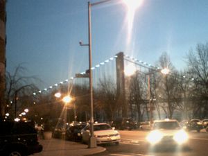
ضاحية فورت هاملتون
Historic Fort Hamilton Army Base is located in the southwestern corner of the New York City borough of Brooklyn, with gates in Bay Ridge and Dyker Heights, and is one of several posts that are part of the region which is headquartered by the Military District of Washington. Its mission is to provide the New York metropolitan area with military installation support for the Army National Guard and the United States Army Reserve. The base is considered to be part of Bay Ridge. The children stationed at the base are zoned into Bay Ridge schools.
Fort Hamilton houses one of the neighborhood's few cultural attractions, the Harbor Defense Museum.[85]
الشرطة والجريمة
The NYPD's 68th Precinct is located at 333 65th Street.[5] The 68th Precinct ranked 7th safest out of 69 patrol areas for per-capita crime in 2010.[86] اعتبارا من 2018[تحديث], with a non-fatal assault rate of 23 per 100,000 people, Bay Ridge and Dyker Heights' rate of violent crimes per capita is less than that of the city as a whole. The incarceration rate of 168 per 100,000 people is lower than that of the city as a whole.[87]
The 68th Precinct has a lower crime rate than in the 1990s, with crimes across all categories having decreased by 88.6% between 1990 and 2018. The precinct reported 2 murders, 16 rapes, 59 robberies, 129 felony assaults, 96 burglaries, 387 grand larcenies, and 86 grand larcenies auto in 2018.[88]
المطافي
The New York City Fire Department (FDNY) contains two fire stations in Bay Ridge.[89] Engine Co. 241/Ladder Co. 109 is located at 6630 3rd Avenue.[90] Engine Co. 242, serving primarily Fort Hamilton, is located at 9219 5th Avenue.[91]
النقل
التعليم
المدارس الابتدائية والثانوية
المكتبات العامة
السياسة
For many years, Bay Ridge has been a relatively conservative enclave of Brooklyn.[92] Mike Long, who served as chairman of the Conservative Party of New York from 1988 to 2019, owned a liquor store and resided in the district. The community is also considered a Republican stronghold. An exception was Democrat Sal Albanese, who was elected to the neighborhood's City Council seat in 1983, defeating the 21-year incumbent Republican-Conservative Minority Leader Angelo G. Arculeo, and went on to represent the district for 15 years. After the 1990 census, the area was split into two Assembly districts to eliminate a Republican Assembly Seat. The political landscape began to change with population shifts over the 1990s and early 2000s, when the multigenerational white ethnic population began to die or move from the area.
The community supported the Democratic Party during many presidential elections.[93][94] In the 2010s, the neighborhood increasingly supported Democrats, such as City Councilmember Justin Brannan (elected in 2017).[95][96] and state senator Andrew Gounardes (elected in 2018, defeating longtime Republican Marty Golden).[97]
The neighborhood is part of New York's 11th congressional district, represented by Republican Nicole Malliotakis اعتبارا من 2021[تحديث].[98] It is also part of the 26th State Senate district, represented by Gounardes,[99] and the 46th, 51st and 64th State Assembly districts, represented respectively by Republican Alec Brook-Krasny, Democrat Marcela Mitaynes and Republican Michael Tannousis.[100]
مشاهير باي ريدج
في الثقافة الشعبية
الكتب
- بين قمرين، أولى روايات عائشة عبد الجواد، تدور في مجتمع المهاجرين العرب في باي ريدج، بروكلن، في شهر رمضان.[101]
- Two of Lawrence Block's Matthew Scudder novels, When the Sacred Ginmill Closes and A Walk Among the Tombstones, are partially set in Bay Ridge.[102]
- Kenneth H. Brown's The Narrows (1970) is set in Bay Ridge during the 1950s.[103]
- The Fort Hamilton army base is the setting for most of Nelson DeMille's novel Word of Honor (1985).[104]
- Tom McDonough's novel Virgin with Child is set in Bay Ridge.[105]
- Several short stories by Hubert Selby, Jr. are set in the neighborhood, including "Liebesnacht" and "Double Feature".[106] Some of his novels are also set in the neighborhood or nearby, like Last Exit to Brooklyn and The Demon.[107]
- Several novels by Gilbert Sorrentino are set in the neighborhood, including Steelwork, Red the Fiend, Crystal Vision, A Strange Commonplace, Little Casino, and The Abyss of Human Illusion.[108]
الأفلام
- The movie Saturday Night Fever (1977) was set in Bay Ridge as well as Sunset Park and Bensonhurst[109]
- The film White Irish Drinkers (2010), directed by John Gray, is set in Bay Ridge[110]
البرامج التلفزيونية
- NYPD Commissioner Frank Reagan (Tom Selleck) on CBS-TV's Blue Bloods lives in Bay Ridge; his home at 8070 Harbor View Terrace, near Fort Hamilton High School, is seen in each episode[111]
- The 2012 reality series Brooklyn 11223 was set in Bay Ridge[112]
- Peggy Olson, the Norwegian-American copywriter on AMC's Mad Men, is from Bay Ridge.[113] In the second episode of Season One, she declared, "I'm from Bay Ridge. We have manners."
المراجع
ملاحظات
الهامش
- ^ أ ب "NYC Planning | Community Profiles". communityprofiles.planning.nyc.gov. New York City Department of City Planning. Retrieved March 18, 2019.
- ^ Census Shapefile for 2014 Zip Code Tabulation Areas Area of 11209 Zip Code Tabulation Area
- ^ خطأ استشهاد: وسم
<ref>غير صحيح؛ لا نص تم توفيره للمراجع المسماةPLP5 - ^ "F.Y.I." Archived فبراير 24, 2022 at the Wayback Machine, The New York Times, December 17, 1995. Accessed February 23, 2022. "More than a century ago, the area now known as Bay Ridge was called Yellow Hook, according to documents from the Bay Ridge Historical Society. The name referred to the yellow sand and clay in the soil. But yellow fever swept through the area in 1848-49, and the name Yellow Hook suddenly lost its charm.... So in December 1853, many of the large landowners from the area met to change the name. A florist named James Weir put forth the name Bay Ridge as one that suggested the 'geographic nature' of the land."
- ^ أ ب "NYPD – 68th Precinct". www.nyc.gov. Archived from the original on June 5, 2017. Retrieved October 3, 2016.
- ^ Current City Council Districts for Kings County Archived يناير 31, 2017 at the Wayback Machine, New York City. Accessed May 5, 2017.
- ^ أ ب ت ث "Sunset Park South Historic District" (PDF). New York City Landmarks Preservation Commission. June 18, 2019. Archived (PDF) from the original on August 6, 2019. Retrieved August 6, 2019.
- ^ Bolton, Reginald P. (2018). Indian Paths in the Great Metropolis. Creative Media Partners, LLC. pp. 129–146. ISBN 978-0-343-11305-6. Archived from the original on July 29, 2024. Retrieved August 6, 2019.
- ^ أ ب ت ث "Beautiful Bay Ridge Still Show Place of Brooklyn". Brooklyn Daily Eagle. September 30, 1940. p. 9. Archived from the original on July 29, 2024. Retrieved August 6, 2019 – via Brooklyn Public Library; newspapers.com
 .
.
- ^ Henry (August 10, 2015). "The Rarely Told Story of the Real Bay Ridge Natives". Hey Ridge. Archived from the original on August 6, 2019. Retrieved August 6, 2019.
- ^ أ ب ت ث ج ح خ "Bay Ridge Parkway – Doctors' Row Historic District" (PDF). New York City Landmarks Preservation Commission. June 25, 2019. Archived (PDF) from the original on August 6, 2019. Retrieved July 28, 2019.
- ^ "Whatever happened to Yellow Hook, Brooklyn?". Ephemeral New York. July 16, 2010. Archived from the original on August 12, 2014. Retrieved December 1, 2014.
- ^ Hughes, C. J. (March 6, 2020). "The Neighborhood Name Game". The New York Times (in الإنجليزية الأمريكية). ISSN 0362-4331. Archived from the original on August 30, 2020. Retrieved August 21, 2020.
- ^ أ ب "Howard E. and Jessie Jones House" (PDF). New York City Landmarks Preservation Commission. March 8, 1988. Archived (PDF) from the original on August 6, 2019. Retrieved July 28, 2019.
- ^ Stewart, Henry (November 6, 2014). "The First Gentrifiers". BKLYNR. Archived from the original on November 20, 2014. Retrieved December 1, 2014.
- ^ Theodore W. General (December 12, 2016). "Generally Speaking: Happy Birthday, Bay Ridge!". Brooklyn Reporter. Archived from the original on December 20, 2016. Retrieved December 13, 2016.
- ^ "Failure to Create Park Along Shore Road Laid To Apathy of Residents". the Brooklyn Daily Eagle. No. September 2, 1931. Archived from the original on October 27, 2016. Retrieved July 27, 2015.
- ^ "Owl's Head Park – Historical Sign". Archived from the original on September 29, 2007. Retrieved September 6, 2007.
- ^ Donovan, Aaron (June 10, 2001). "If You're Thinking of Living In Red Hook; Isolated Brooklyn Area Starts to Awaken". The New York Times. Archived from the original on July 29, 2024. Retrieved August 27, 2010.
- ^ أ ب Fowler, Brenda (July 26, 1987). "If You're Thinking of Living In Bay Ridge". The New York Times. Archived from the original on August 24, 2010. Retrieved August 27, 2010.
- ^ أ ب ت "Bennet-Farrell-Feldman House" (PDF). New York City Landmarks Preservation Commission. August 3, 1999. Archived (PDF) from the original on July 29, 2024. Retrieved July 28, 2019.
- ^ "When Bay Ridge Was a Vacation Destination to Rival Coney Island". Hey Ridge. August 2, 2016. Archived from the original on February 5, 2017. Retrieved July 11, 2017.
- ^ أ ب ت ث ج Merlis, Brian (2000). Brooklyn's Bay Ridge and Fort Hamilton : a photographic journey, 1870-1970. Brooklyn, NY Lynbrook, NY: Israelowitz Pub. Brooklyn Editions. ISBN 978-1-878741-45-5. OCLC 45112683.
- ^ "Brooklyn City's Beautiful Suburbs". The New York Times. March 31, 1895. pp. 20–21. Retrieved March 4, 2023.
- ^ أ ب Henry (June 22, 2015). "Bay Ridge's Parks Were Once Envisioned as a Single Super Park". Hey Ridge. Archived from the original on August 6, 2019. Retrieved August 6, 2019.
- ^ أ ب ت "Future of South Brooklyn And Its Suburbs". The Brooklyn Daily Eagle (in الإنجليزية). March 18, 1906. pp. 35–36. Archived from the original on August 7, 2017. Retrieved May 5, 2017.
- ^ "Marked Activity Continues in Local Real Estate Market". Brooklyn Daily Eagle. December 14, 1901. p. 17. Archived from the original on July 29, 2024. Retrieved August 6, 2019 – via Brooklyn Public Library; newspapers.com
 .
.
- ^ أ ب "Parsons' Great Transit Plan for Brooklyn; New Tunnels, Subways and Elevated Lines". Brooklyn Daily Eagle. March 12, 1903. p. 1. Archived from the original on July 29, 2024. Retrieved August 6, 2019 – via Brooklyn Public Library; newspapers.com
 .
.
- ^ أ ب ت "Building of Fourth Ave. Subway Crowns Decade of Civic Struggle". The Brooklyn Daily Eagle (in الإنجليزية). June 21, 1911. p. 10. Archived from the original on August 6, 2017. Retrieved May 4, 2017.
- ^ "Realty Market Steady Despite Campaign". Brooklyn Daily Eagle. October 28, 1905. p. 12. Retrieved August 6, 2019 – via Brooklyn Public Library; newspapers.com
 .
.
- ^ أ ب ت ث ج ح Fourth Avenue Subway, Brooklyn's New Transportation Line: A Part of the Dual System of Rapid Transit of the City of New York (in الإنجليزية). Public Service Commission. June 19, 1915. Archived from the original on September 18, 2023. Retrieved October 15, 2020.
- ^ أ ب "Fourth Avenue Subway Is Sent To A Committee". The Brooklyn Daily Eagle (in الإنجليزية). March 20, 1908. pp. 1–2. Archived from the original on August 7, 2017. Retrieved May 4, 2017.
- ^ أ ب Rogoff, David (May 1961). "New York Division ERA Bulletin May 1961". Google Docs. Archived from the original on August 6, 2019. Retrieved May 8, 2017.
- ^ "Fourth Avenue Subway To Be Political Issue". The Brooklyn Daily Eagle (in الإنجليزية). December 11, 1908. p. 1. Archived from the original on May 7, 2018. Retrieved May 4, 2017.
- ^ "Crappy 100th Birthday, R Train! Love, Bay Ridge". www.heyridge.com. January 14, 2016. Archived from the original on May 27, 2017. Retrieved May 4, 2017.
- ^ "Fourth Ave. Subway Dirt Begins to Fly" (PDF). The New York Times. November 14, 1909. Archived (PDF) from the original on August 10, 2021. Retrieved June 28, 2015.
- ^ "Queensboro Tunnel Officially Opened" (PDF). The New York Times. June 23, 1915. p. 22. Archived (PDF) from the original on July 19, 2021. Retrieved March 4, 2023.
- ^ "Subway Running To Eighty–Sixth Street Starts Building Boom In Bay Ridge". Brooklyn Daily Eagle. January 15, 1916. Archived from the original on November 6, 2016. Retrieved November 5, 2016 – via Newspapers.com.
- ^ "Brooklyn's Rapid Growth Attracts Many Buyers". The New York Times. May 8, 1904. p. 18. Retrieved March 6, 2023.
- ^ Gallagher, Frank (May 3, 1908). "South Brooklyn is Port of Future". The New York Times. p. B3. Retrieved March 6, 2023.
- ^ أ ب Scarpa, Matthew (2015). Old Bay Ridge & Ovington Village : a history. Charleston, SC: The History Press. ISBN 978-1-62619-681-0. OCLC 898088560.
- ^ Hoffman, Jerome (1976). The Bay Ridge Chronicles.
- ^ "95th St. Subway Extension Opened At 2 P. M. Today". Brooklyn Daily Eagle. October 31, 1925. Archived from the original on August 11, 2017. Retrieved June 29, 2015 – via Newspapers.com.
- ^ "Open Subway Line to Fort Hamilton". The New York Times. November 1, 1925. p. 19. ISSN 0362-4331. Retrieved March 6, 2023.
- ^ Bernard, Leonardo and Jennifer Weiss (2006). Brooklyn by Name. New York: NYU Press. p. 145.
- ^ "To Tunnel The Narrows And Thus Improve New York's Commercial Facilities: Mr. Erastus Wiman's Latest Plan Upon Which He and Others Have Long Been Mediating" (PDF). The New York Times. August 5, 1890. Archived (PDF) from the original on August 10, 2021. Retrieved July 27, 2015.
- ^ "DC: A Tunnel from SI to Brooklyn?". Daniel Convissor. Archived from the original on August 30, 2018. Retrieved December 16, 2010.
- ^ Young, James C. (May 10, 1925). "Staten Island Waits for Narrows Tunnel" (PDF). The New York Times. Archived (PDF) from the original on July 29, 2024. Retrieved June 27, 2015.
- ^ "Staten Island Tube Started by Hylan" (PDF). The New York Times. April 15, 1923. Archived (PDF) from the original on July 29, 2024. Retrieved June 27, 2015.
- ^ Rastorfer, Darl (2000). "Chapter 7: The Verrazano-Narrows Bridge". Six Bridges: The Legacy of Othmar H. Ammann. Yale University Press. ISBN 978-0-300-08047-6. Archived from the original on April 7, 2024. Retrieved September 18, 2018.
- ^ "ASKS SUBURBAN AID IN REGIONAL PLAN; Committee Urges Cooperation in Furthering Important Public Improvements. WANT COUNTIES TO HELP Transit, Bridges, Skyscrapers and Financing Among the Subjects Discussed". The New York Times (in الإنجليزية الأمريكية). June 7, 1927. ISSN 0362-4331. Archived from the original on March 15, 2018. Retrieved March 14, 2018.
- ^ "SAYS BRIDGES BOOM REALTY IN RICHMOND; Many Industrial Firms Are Seeking Staten Island Sites, Says Real Estate Operator.NEW SPANS HELP VALUESGreat Commercial Centre in FiveYears Is Predicted--HoldingsSought Near Plaza Site". The New York Times (in الإنجليزية الأمريكية). January 1, 1928. ISSN 0362-4331. Archived from the original on March 14, 2018. Retrieved March 13, 2018.
- ^ "Tube Projects to be Scanned by Chamber of Commerce Body". Brooklyn Daily Eagle. November 27, 1931. p. 41. Archived from the original on March 14, 2018. Retrieved March 14, 2018 – via Brooklyn Public Library; newspapers.com.
- ^ "Private Group Studying Plans for Vehicular and Transit Narrows Tunnel". Brooklyn Daily Eagle. May 11, 1934. p. 41. Archived from the original on March 14, 2018. Retrieved March 14, 2018 – via Brooklyn Public Library; newspapers.com.
- ^ "MAYOR WILL URGE NARROWS BRIDGE; Estimate Board Authorizes Reopening of the Project With War Department". The New York Times (in الإنجليزية الأمريكية). April 18, 1936. ISSN 0362-4331. Archived from the original on March 14, 2018. Retrieved March 13, 2018.
- ^ "Bay Ridge Aroused by Narrows Tube O.K." Brooklyn Daily Eagle. March 22, 1943. pp. 1, 2. Archived from the original on March 15, 2018. Retrieved March 14, 2018 – via Brooklyn Public Library; newspapers.com.
- ^ Pierce, Bert (September 24, 1947). "CITY PLANS TO BUILD SPAN AT NARROWS; Moses Says He Expects Early Approval of Bridge Project by War Department CITY PLANS TO BUILD SPAN AT NARROWS". The New York Times (in الإنجليزية الأمريكية). ISSN 0362-4331. Archived from the original on March 15, 2018. Retrieved March 14, 2018.
- ^ "REALTY FRAUD SEEN IN NARROWS BRIDGE; O'Toole Says Proposed Span Would Lead to City's 'Greatest Swindle in History'". The New York Times (in الإنجليزية الأمريكية). 1949. ISSN 0362-4331. Archived from the original on March 14, 2018. Retrieved March 14, 2018.
- ^ "O'Toole Urges U.S. Ban Bridge over Narrows". Brooklyn Daily Eagle. July 19, 1948. pp. 1, 3. Archived from the original on March 15, 2018. Retrieved March 14, 2018 – via Brooklyn Public Library; newspapers.com.
- ^ "Army Approves Narrows Bridge, World's Longest Suspension Span; ARMY BACKS SPAN OVER THE NARROWS". The New York Times (in الإنجليزية الأمريكية). May 25, 1949. ISSN 0362-4331. Archived from the original on March 15, 2018. Retrieved March 14, 2018.
- ^ "Bay Ridgeites Battle Army Okay on Span". Brooklyn Daily Eagle. May 25, 1949. pp. 1, 2. Archived from the original on March 15, 2018. Retrieved March 14, 2018 – via Brooklyn Public Library; newspapers.com.
- ^ Bennett, Charles G. (June 20, 1957). "SPAN APPROACHES APPROVED BY CITY; Narrows and Throgs Neck Routes Are Advanced by Planning Commission MOSES' PLAN REBUFFED Fourth Ave. Curve Is Deleted in Brooklyn--Alternate Ideas to Be Studied Argue Against Curve Final Action Taken". The New York Times (in الإنجليزية الأمريكية). ISSN 0362-4331. Archived from the original on October 3, 2018. Retrieved March 14, 2018.
- ^ "CITY BARS CHANGE IN NARROWS PLAN; Rejects Liberty Bridge or Tunnel as Substitutes -No Action on Approach CITY BARS CHANGE IN NARROWS PLAN". The New York Times (in الإنجليزية الأمريكية). October 21, 1958. ISSN 0362-4331. Archived from the original on March 15, 2018. Retrieved March 14, 2018.
- ^ Talese, Gay (January 1, 1959). "BAY RIDGE SEETHES OVER BRIDGE PLAN; Housewife and Dentist Chafe Over Approval by City of Staten Island Span 7,500 TO BE UPROOTED Most in Way of 7th Avenue Approach Uncertain on Where They Will Go". The New York Times (in الإنجليزية الأمريكية). ISSN 0362-4331. Archived from the original on March 15, 2018. Retrieved March 14, 2018.
- ^ "The definitive history of the building of the bridge is Gay Talese's The Bridge". Archived from the original on September 30, 2007. Retrieved February 27, 2007.
- ^ Chatfield, James (April 1, 1960). "Fort Hamilton Facelift Is Free To Taxpayer, As TBTA Pays Bill" (PDF). New York World-Telegram. p. 1. Archived (PDF) from the original on July 29, 2024. Retrieved March 14, 2018 – via Fultonhistory.com.
- ^ Talese, Gay (November 22, 1964). "Verrazano Bridge Opened to Traffic". The New York Times (in الإنجليزية الأمريكية). ISSN 0362-4331. Archived from the original on March 16, 2018. Retrieved March 16, 2018.
- ^ "Photos and a story of the aftermath of the Bay Ridge tornado". Archived from the original on October 17, 2007. Retrieved October 2, 2007.
- ^ The Phantom (August 17, 2007). "Bay Ridge Tornado: Fourth Avenue Presbyterian Church". Archived from the original on July 25, 2011. Retrieved August 21, 2010.
- ^ Newman, Andy (August 9, 2007). "That Wind That Left Part of Brooklyn Upside Down? It Was a Tornado, All Right". The New York Times. Archived from the original on November 8, 2014. Retrieved August 27, 2010.
- ^ أ ب "Norwegians of Bay Ridge, a Proud and Tight-Knit Community". The New York Times. May 16, 1971. Archived from the original on August 8, 2019. Retrieved August 8, 2019.
- ^ "Leif Ericson Park & Square (New York City Department of Parks & Recreation)". Archived from the original on September 15, 2010. Retrieved October 21, 2009.
- ^ "17th of May Parade (Norwegian-American 17th May Committee of Greater New York)". Archived from the original on September 21, 2009. Retrieved October 21, 2009.
- ^ Jaeger, Max (January 8, 2015). "Bay Ridge's Nordic Delicacies Set to Close". Brooklyn Paper. Archived from the original on June 17, 2017. Retrieved July 11, 2017.
- ^ Otterman, Sharon (July 28, 2012). "Times of Celebration, Before and After a Daily Fast". The New York Times (in الإنجليزية الأمريكية). ISSN 0362-4331. Archived from the original on July 12, 2021. Retrieved July 12, 2021.
- ^ "A New Resistance in Brooklyn's 'Little Palestine'". October 6, 2017. Archived from the original on July 29, 2024. Retrieved July 18, 2023.
- ^ Vecchione, Carol (March 28, 1984). "Hart Staying Alive in Brooklyn". UPI. Archived from the original on August 11, 2018. Retrieved July 11, 2017.
- ^ Frank, Dave. "Geology of National Parks". 3dparks.wr.usgs.gov. Archived from the original on December 19, 2016. Retrieved July 11, 2017.
- ^ Mooney, Jake (January 1, 2006). "Counting Graying Heads". The New York Times. p. 6. Retrieved August 27, 2010.
- ^ "Find the Classic Bay Ridge at Nordic Delicacies".
- ^ "Leif Ericson Park & Square (New York City Department of Parks & Recreation)".
- ^ "17th of May Parade (Norwegian-American 17th May Committee of Greater New York)".
- ^ "NYC Zoning - Zoning Districts". nyc.gov. Archived from the original on December 7, 2014. Retrieved December 1, 2014.
- ^ Kripke, Pamela Gwyn (April 6, 2016). "Bay Ridge, Brooklyn, a 'Small Town' in a Big City". The New York Times. ISSN 0362-4331. Retrieved April 7, 2016.
- ^ "Harbor Defense Museum of Fort Hamilton". Archived from the original on July 9, 2011. Retrieved February 27, 2007.
- ^ "Bay Ridge – DNAinfo.com Crime and Safety Report". www.dnainfo.com. Archived from the original on March 2, 2019. Retrieved October 6, 2016.
- ^ خطأ استشهاد: وسم
<ref>غير صحيح؛ لا نص تم توفيره للمراجع المسماةCHP2018 - ^ "68th Precinct CompStat Report" (PDF). Archived (PDF) from the original on April 13, 2018. Retrieved July 22, 2018.
- ^ قالب:Cite FDNY locations
- ^ "Engine Company 241/Ladder Company 109". FDNYtrucks.com. Archived from the original on January 27, 2019. Retrieved March 2, 2019.
- ^ "Engine Company 242". FDNYtrucks.com. Archived from the original on October 25, 2018. Retrieved March 2, 2019.
- ^ Ross Barkan (August 19, 2014). "Bill de Blasio Rarely Visits Republican Strongholds in Brooklyn - Observer". Observer. Retrieved May 20, 2017.
- ^ "The City Vote, Precinct by Precinct" (in الإنجليزية). Archived from the original on November 24, 2018. Retrieved November 20, 2018.
- ^ "Did your NYC neighborhood vote for Donald Trump or Hillary Clinton?". Curbed NY. Archived from the original on November 24, 2018. Retrieved November 20, 2018.
- ^ "Justin time: Ridge voters elect Democrat in tight Council race • Brooklyn Daily". Brooklyn Daily. November 10, 2017. Archived from the original on August 7, 2018. Retrieved August 7, 2018.
- ^ "This punk-rocking councilman is energizing Brooklyn Dems". New York Post (in الإنجليزية الأمريكية). November 19, 2018. Archived from the original on July 29, 2024. Retrieved November 20, 2018.
- ^ Katinas, Paula (November 20, 2018). "Behind the Numbers: How Gounardes Won State Senate Race". The Brooklyn Home Reporter. Archived from the original on December 6, 2019. Retrieved December 6, 2019.
- ^ "U.S. House Election Results 2018". The New York Times. January 28, 2019. Archived from the original on January 19, 2021. Retrieved February 21, 2019.
- ^ "2022 Senate District Maps: New York City". The New York State Legislative Task Force on Demographic Research and Reapportionment. 2022. Archived from the original on December 7, 2023. Retrieved December 7, 2023.
- ^ "2024 Assembly District Maps: New York City". The New York State Legislative Task Force on Demographic Research and Reapportionment. 2024. Archived from the original on July 29, 2024. Retrieved December 7, 2023.
- ^ "Between Two Moons by Aisha Abdel Gawad: 9780385548618 | PenguinRandomHouse.com: Books". PenguinRandomhouse.com. Archived from the original on April 11, 2023. Retrieved April 11, 2023.
- ^ "The Bay Ridge Canon: Lawrence Block Crime Novels". Hey Ridge. January 3, 2017. Archived from the original on August 21, 2017. Retrieved July 11, 2017.
- ^ "The Bay Ridge Canon: The Narrows by Kenneth H. Brown". Hey Ridge. September 19, 2016. Archived from the original on November 17, 2016. Retrieved July 11, 2017.
- ^ Stewart, Henry (July 24, 2015). "The Bay Ridge Canon: Word of Honor by Nelson DeMille". Hey Ridge. Archived from the original on July 25, 2015. Retrieved July 24, 2015.
- ^ Stewart, Henry (August 5, 2015). "The Bay Ridge Canon: Virgin with Child by Tom McDonough". Hey Ridge. Archived from the original on August 8, 2015. Retrieved August 5, 2015.
- ^ Selby, Hubert (1986). Song of the Silent Snow. pp. 1–4, 19–30, 57–78.
- ^ Stewart, Henry. "Fifty Years Later, Looking for Last Exit". Bklynr. Archived from the original on April 7, 2015. Retrieved April 21, 2015.
- ^ Stewart, Henry (August 11, 2014). "Gilbert Sorrentino: The Lost Laureate of Brooklyn". Electric Literature.
- ^ Stewart, Henry (November 7, 2016). "Reel Brooklyn: Saturday Night Fever". Brooklyn Magazine. Archived from the original on November 27, 2017. Retrieved July 11, 2017.
- ^ "White Irish Drinkers Director: "I Love Saturday Night Fever!"". The L Magazine. March 23, 2011. Archived from the original on November 7, 2014. Retrieved November 7, 2014.
- ^ "Blue Bloods - The Best Dining Room on TV". September 28, 2012. Archived from the original on February 12, 2015. Retrieved February 11, 2015.
- ^ "Bay Ridge is Really Pissed About This New Reality Show". The L Magazine. February 23, 2012. Archived from the original on September 26, 2015. Retrieved July 11, 2017.
- ^ "Mad Men's Native Brooklynite Explains the Mystery of Her Heritage". The L Magazine.[dead link]
قراءات إضافية
- Rygg, Andreas Nilsen. Norwegians in New York, 1825–1925 (Brooklyn, New York: Norwegian News Co. 1941)
وصلات خارجية
40°37′37″N 74°01′52″W / 40.627°N 74.031°W{{#coordinates:}}: لا يمكن أن يكون هناك أكثر من وسم أساسي واحد لكل صفحة
- Pages using gadget WikiMiniAtlas
- صفحات بها مخططات
- CS1 الإنجليزية الأمريكية-language sources (en-us)
- CS1: Julian–Gregorian uncertainty
- Articles with dead external links from August 2025
- صفحات ذات وسوم إحداثيات غير صحيحة
- Short description is different from Wikidata
- Articles with hatnote templates targeting a nonexistent page
- Missing redirects
- Coordinates on Wikidata
- Pages using New York City Subway service templates
- Articles with unsourced statements from April 2021
- مقالات فيها عبارات متقادمة منذ 2023
- جميع المقالات التي فيها عبارات متقادمة
- مقالات فيها عبارات متقادمة منذ 2018
- مقالات فيها عبارات متقادمة منذ 2021
- ضواحي بروكلين
- باي ريدج، بروكلين
- صفحات مع خرائط معطوبة

