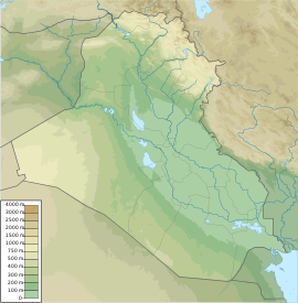
جبل الحاج إبراهيم Kuh-e Haji Ebrahim
| Kuhe Haji Ebrahim | |
|---|---|
| أعلى نقطة | |
| الارتفاع | 3،587 m (11،768 ft) |
| البروز | 1،747 m (5،732 ft) |
| الإدراج | Ultra |
| الإحداثيات | 36°33′N 45°00′E / 36.550°N 45.000°E |
| التسمية | |
| کوه حاجی ابراهیم (بالفارسي) Error {{native name checker}}: parameter value is malformed (help) | |
| الجغرافيا | |
| Location | Iran–Iraq border |
| السلسلة الأم | جبال زاگروس |
Kuh-e Haji Ebrahim (فارسية: کوه حاجی ابراهیم) is a mountain of the Qandil Mountains, a subrange of the Zagros Mountains. The peak is located in western Iran and eastern Iraq, in western Asia.
Haji Ebrahim has an elevation of 3،587 متر (11،768 ft) and sits on the international Iran-Iraq border.[1]
See also
References
- ^ "Kuhe Haji Ebrahim, Iraq/Iran". Peakbagger.com.
This article may include material from Wikimedia licensed under CC BY-SA 4.0. Please comply with the license terms.
تصنيفات:
- Pages using gadget WikiMiniAtlas
- Short description is different from Wikidata
- Coordinates on Wikidata
- Native name checker template errors
- Articles containing فارسية-language text
- Zagros Mountains
- Mountains of Iraq
- International mountains of Asia
- Iran–Iraq border
- Landforms of West Azerbaijan province
- Mountains of Kurdistan
- Three-thousanders of Asia
- Mountains of Kurdistan Province
- Mountains of Iran
- بذرة جغرافيا العراق
