زيپلنگن Sipplingen
زيپلنگن | |
|---|---|
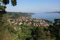
 منظر شمالي غربي لزيبلنجن | |
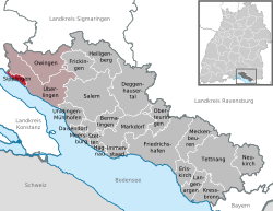
موقع زيپلنگن within مقاطعة بودنزي district | |
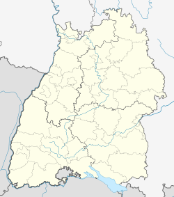
| الإحداثيات: 47°47′45″N 09°05′45″E / 47.79583°N 9.09583°E | |
| البلد | ألمانيا |
| الولاية | بادن-ڤورتمبرگ |
| Admin. region | Tübingen |
| District | مقاطعة بودنزي |
| الحكومة | |
| • العمدة | Oliver Gortat[1] |
| المساحة | |
| • الإجمالي | 4٫28 كم² (1٫65 ميل²) |
| المنسوب | 406 m (1٬332 ft) |
| منطقة التوقيت | CET/CEST (UTC+1/+2) |
| Postal codes | 78354 |
| Dialling codes | 07551 |
| لوحة السيارة | FN |
| الموقع الإلكتروني | www.sipplingen.de |
زيپلنگن Sipplingen هي بلدية في مقاطعة بودنزي في بادن-ڤورتمبرگ في ألمانيا.
التاريخ
المنطقة المحيطة بزيبلنجن كانت مأهولة لزمن بعيد. The very well-preserved sequence of sediment layers on the Sipplingen shore of Lake Constance has proven to be a rich archaeological site for Stone Age , Neolithic and Bronze Age pile-dwelling settlements . Around 20 settlements have now been identified. [ 4 ] Dendrochronological studies date the first settlement to exactly 3919 BC and the last to 933 BC. [ 5 ] In addition, in 2008 diving archaeologists from the State Office for Monument Preservation in Baden-Württemberg found a prehistoric shoe in a shallow water zone off Sipplingen. It is a very well-preserved sandal woven from linden bast and dated between 2917 and 2856 BC. [ 6 ] [ 7 ] [ 8 ]
The village of Sipplingen probably arose between the 6th and 8th centuries. The first written mention of the place is as Sipelingen in a document from the year 1155 [ 9 ] , in which Emperor Frederick I (Barbarossa) defined the borders of the diocese of Constance . A document allegedly from the year 965 mentioning Sipplingen as Sibelingen is now considered a forgery from the second half of the 12th century.
Sipplingen belonged to the Landgraviate of Nellenburg in the Holy Roman Empire and in 1805 it first fell to the Electorate, and in 1806 to the Kingdom of Württemberg . Through the border treaty of 1810 , Sipplingen became part of the Grand Duchy of Baden . There the community belonged to the Überlingen district office , and since 1 January 1939 to the Überlingen district .
For a long time, Sipplingen developed in relative isolation. Due to its steep bank location, roads and rail connections to neighboring communities were only built in the 19th century. In the 20th century, agriculture, which had dominated until then, lost importance and the town developed into a residential community.
In 1945 the town became part of the French occupation zone and thus belonged to the newly founded southern state of Baden , which in 1952 was incorporated into the administrative district of South Baden of the new federal state of Baden-Württemberg. In 1973 the district reform in Baden-Württemberg took place , during which Sipplingen became part of the Bodenseekreis .
In 1987, the village won a gold medal in the national competition “ Our Village Should Become More Beautiful” .
Near Sipplingen are the remains of the castles Haldenberg , Hohenfels and Hüneberg .
موقع للتراث العالمي
زيبلنجن هي مكان لواحدة أو أكثر من مستعمرات ما قبل التاريخ مساكن من قبل التاريخ على خوازيق تشكل جزءاً من موقع التراث العالمي حسب اليونسكو مساكن على خوازيق قبل التاريخ حول الألپ.[2]
وفي 10 مارس 2009 - في زيپلنگن (جنوب ألمانيا)، اعلان اكتشاف صنادل مضفرة تعود لعام 2900 ق.م. وكان علماء الآثار الغواصون قبل أسابيع قد اكتشفوها في حالة جيدة في منازل على قوائم ببحيرة.
المراجع
- ^ Aktuelle Wahlergebnisse, Staatsanzeiger, accessed 11 September 2021.
- ^ UNESCO World Heritage Site - Prehistoric Pile dwellings around the Alps
قالب:Cities and towns in Bodensee (district) قالب:Lake Constance


