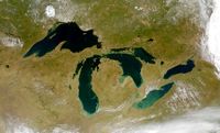
نهر نياگرا Niagara River
| جزء من سلسلة مقالات عن |
| التمييز |
|---|
 |
| أشكال محددة |
| Niagara River | |
|---|---|
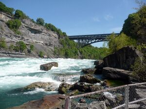 The Niagara River at Niagara Gorge in May 2008 | |
خطأ: إحداثيات غير صالحة. | |
| الموقع | |
| Countries | |
| Province / State | |
| السمات الطبيعية | |
| المنبع | Lake Erie |
| ⁃ المنسوب | 173.43 m (569 ft)[1] |
| المصب | Lake Ontario |
- الإحداثيات | 43°04′41″N 79°04′37″W / 43.078°N 79.077°W |
- المنسوب | 74.1 m (243 ft)[2] |
| الطول | 58 km (36 mi)[3] |
| مساحة الحوض | 684،000 km2 (264،000 sq mi)[3] |
| التدفق | |
| ⁃ المتوسط | 5،796 m3/s (204،700 cu ft/s)[4] |
| سمات الحوض | |
| السريان | قالب:PLake Ontario |
| الروافد | |
| - اليسرى | Welland River |
| - اليمنى | Tonawanda Creek |
| خطأ: الوظيفة "main" غير موجودة. | |
| الاسم الرسمي | Niagara River Corridor |
| التوصيف | 3 October 2019 |
| الرقم المرجعي | 2402[5] |
Niagara River | |||||||||||||||||||||||||||||||||||||||||||||||||||||||||||||||||||||||||||||||||||||||||||||||||||||||||||||||||||||||||||||||||||||||||||||||||||||||||||||||||||||||||||||||||||||||||||||||||||||||||||||||||||||||||||||||||||||||||||||||||||||||||||||||||||||
|---|---|---|---|---|---|---|---|---|---|---|---|---|---|---|---|---|---|---|---|---|---|---|---|---|---|---|---|---|---|---|---|---|---|---|---|---|---|---|---|---|---|---|---|---|---|---|---|---|---|---|---|---|---|---|---|---|---|---|---|---|---|---|---|---|---|---|---|---|---|---|---|---|---|---|---|---|---|---|---|---|---|---|---|---|---|---|---|---|---|---|---|---|---|---|---|---|---|---|---|---|---|---|---|---|---|---|---|---|---|---|---|---|---|---|---|---|---|---|---|---|---|---|---|---|---|---|---|---|---|---|---|---|---|---|---|---|---|---|---|---|---|---|---|---|---|---|---|---|---|---|---|---|---|---|---|---|---|---|---|---|---|---|---|---|---|---|---|---|---|---|---|---|---|---|---|---|---|---|---|---|---|---|---|---|---|---|---|---|---|---|---|---|---|---|---|---|---|---|---|---|---|---|---|---|---|---|---|---|---|---|---|---|---|---|---|---|---|---|---|---|---|---|---|---|---|---|---|---|---|---|---|---|---|---|---|---|---|---|---|---|---|---|---|---|---|---|---|---|---|---|---|---|---|---|---|---|---|---|---|---|---|
| |||||||||||||||||||||||||||||||||||||||||||||||||||||||||||||||||||||||||||||||||||||||||||||||||||||||||||||||||||||||||||||||||||||||||||||||||||||||||||||||||||||||||||||||||||||||||||||||||||||||||||||||||||||||||||||||||||||||||||||||||||||||||||||||||||||
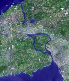
نهر نياگرا بالإنجليزية Niagara River /naɪˈæɡərə, -ɡrə/ ny-AGG-ər-ə, -grə يتدفق شمالاً من بحيرة إيري إلى بحيرة أونتاريو، مشكّلاً جزءاً من الحدود بين أونتاريو في كندا من جهة الغرب، وولاية نيويورك في الولايات المتحدة من جهة الشرق. يُعد أصل اسم النهر موضع جدل؛ إذ يقترح الباحث المختص بالشعوب الإيروكوية بروس تريگر أنه مشتق من فرع من كونفدرالية النيوترال المحلية، الذين أُشير إليهم باسم شعب نياگاگارگا في عدد من الخرائط الفرنسية في أواخر القرن 17.[6] فيما يرى چورچ ر. ستيوارت أن الاسم مشتق من اسم بلدة إيروكوية تُدعى أونڠنياهرا وتعني "نقطة أرض مشطورة إلى نصفين".[7]
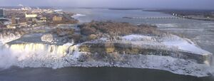
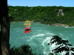
يُوصف النهر أحياناً بأنه مضيق،[8] ويبلغ طوله حوالي 58 كيلومتر (36 mi) ويضم شلالات نياگارا. على مدى 12000 سنة الماضية، تحركت الشلالات نحو المنبع لمسافة تقارب 11 كيلومتر (6.8 mi) من الحافة الأمامية لـمنحدر نياگارا، مما أدى إلى تشكيل وادي سحيق أسفل الشلالات. أما اليوم، فقد أدى تحويل مجرى النهر لأغراض توليد الكهرباء إلى إبطاء معدل التعرية بشكل كبير. يبلغ إجمالي الانخفاض في الارتفاع على طول النهر نحو 99 متر (325 ft). ويضم وادي نياگارا، الواقع أسفل الشلالات، دوامة نياگارا ومجموعة من المنحدرات المائية الأخرى.
تشمل محطات توليد الطاقة على النهر محطات توليد الكهرباء الكهرومائية سير آدام بِك (بُنيت في 1922 و1954) على الجانب الكندي، ومحطة روبرت موزس للطاقة الكهرومائية (بُنيت في 1961) على الجانب الأمريكي، وتُنتج مجتمعة 4.4 گيگاواط من الكهرباء. كما ينظم السد الدولي للتحكم، الذي شُيّد عام 1954، تدفق مياه النهر. وتستخدم السفن العاملة في البحيرات العظمى قناة ويلاند، وهي جزء من ممر سانت لورانس البحري، على الجانب الكندي من النهر لتجاوز شلالات نياگارا.
يضم نهر نياگارا جزيرتين كبيرتين وعدداً من الجزر الصغيرة. جزيرة گراند وجزيرة ناڤي، وهما الأكبر، تقعان في الجانبين الأمريكي والكندي على التوالي. أما جزيرة الماعز (نيويورك) والجزيرة الصغيرة جزيرة لونا فتقسم شلالات نياگارا إلى ثلاثة أقسام: شلال حدوة الحصان، شلال طرحة العروس (شلالات نياگارا)، والشلالات الأمريكية. وتقع جزيرة يونيتي أعلى مجرى النهر بمحاذاة مدينة بافلو (نيويورك).
كان نهر نياگارا وروافده، خور تونواندا ونهر ويلاند، جزءاً من المقطع الأخير لقناة إيري وقناة ويلاند. فبعد مغادرة لوكبورت، تتجه قناة إيري جنوب غرب إلى خور تونواندا. وعند دخول نهر نياگارا، تتابع السفن المائية سيرها جنوباً نحو البوابة الأخيرة، حيث يتيح مقطع قصير من القناة عبور القوارب بأمان متجاوزة المياه المتلاطمة والشواطئ الصخرية وصولاً إلى بحيرة إيري. وتستخدم قنوات ويلاند نهر ويلاند للاتصال بنهر نياگارا جنوب الشلالات، ما يُمكّن حركة الملاحة المائية من العودة إلى النهر بأمان ومواصلة رحلتها إلى بحيرة إيري.
التاريخ
أصبح نهر وشلالات نياگارا معروفين خارج أمريكا الشمالية منذ أواخر القرن السابع عشر، عندما شاهدها لأول مرة الأب لويس هنپان، المستكشف الفرنسي، وكتب عن رحلاته في كتابه اكتشاف جديد لبلاد شاسعة في أمريكا (1698).[9]
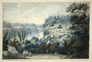
كان نهر نياگارا موقع أول سكة حديد مسجلة في أمريكا. كانت سكة منحدرة خشبية بناها جون مونتريزور (1736–1799)، مهندس عسكري بريطاني، في عام 1764. سُميت "The Cradles" و"المنحدر القديم في لوويستون"، وقد استخدمت عربات تُسحب بالحبال على سكك خشبية لنقل البضائع عبر منحدر نياگارا في ما يُعرف اليوم بـلوويستون (نيويورك).[10]
في عام 1781، وُقع شراء نياگارا، وشمل شريطاً من الأرض بعرض 6.5-كيلومتر (4.0 mi) على الضفة الغربية لنهر نياگارا، يربط بين بحيرتي إيري وأونتاريو.[11]
وقعت عدة معارك على طول نهر نياگارا، الذي كان يُدافع عنه تاريخياً من خلال حصن جورج (أونتاريو) (في الجانب الكندي) وحصن نياگارا (في الجانب الأمريكي) عند مصب النهر، وحصن إيري (الجانب الكندي) عند منبع النهر. كانت هذه الحصون ذات أهمية خلال حرب السنوات السبع (المعروفة في الولايات المتحدة باسم الحرب الفرنسية والهندية) وكذلك خلال الثورة الأمريكية. وقعت معركة مرتفعات كوينستون قرب النهر أثناء حرب 1812.
كان النهر طريقاً مهماً نحو التحرر قبل الحرب الأهلية الأمريكية، حيث عبر العديد من الأمريكيين من أصل أفريقي الهاربين من العبودية عبر سكة حديد الأنفاق النهر إلى كندا بحثاً عن الحرية. ويقف نصب عبور الحرية التذكاري على ضفة النهر في لوويستون تخليداً لشجاعة العبيد الهاربين والمتطوعين المحليين الذين ساعدوهم سراً في عبور النهر.
في ثمانينيات القرن التاسع عشر، أصبح نهر نياگارا أول مجرى مائي في العالم يُستخدم لتوليد الطاقة الكهرومائية على نطاق واسع.[12][13]
على الجانب الكندي من النهر، تتولى وكالة هيئة حدائق نياگارا الإقليمية الإشراف على جميع الممتلكات على الضفة، بما في ذلك حصن إيري، باستثناء مواقع حصن جورج (وهو موقع تاريخي وطني تُشرف عليه الحدائق الكندية فيدرالياً)، وذلك كمساحة خضراء عامة وتراث بيئي.
أما على الجانب الأمريكي، فتُشرف مكتب ولاية نيويورك للمتنزهات والترفيه والمحافظة على التاريخ على عدد من الحدائق العامة المجاورة لشلالات نياگارا ونهر نياگارا.
اليوم، يحمل النهر اسمه إلى هيرالد نياگارا الاستثنائي في السلطة الهيرالدية الكندية.
المدن والبلدات
تشمل المدن والبلدات الواقعة على طول نهر نياگارا ما يلي:
التلوث
أُدرج نهر نياگارا ضمن مناطق القلق في البحيرات العظمى بموجب اتفاقية جودة مياه البحيرات العظمى الموقعة بين الولايات المتحدة وكندا.
المعابر
يتمتع نهر نياگارا بتاريخ طويل من جسور الطرق والسكك الحديدية التي تعبره، سواء في أعلى الشلالات أو أسفلها. ويتضمن هذا التاريخ العديد من الجسور التي انهارت نتيجة للظروف القاسية في وادي نياگارا، مثل الانهيارات الأرضية وتراكمات الجليد.
المنتزهات
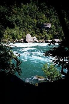
تقع المنتزهات التالية على طول نهر نياگرا:
A Niagara River Greenway Plan is in progress in the United States.
Hydrologic features
| Feature | Location | Country | Notes | Photo |
|---|---|---|---|---|
| Source of Niagara River | 42°54′16″N 78°54′21″W / 42.904325°N 78.905869°W | The Niagara River originates at the north-east end of Lake Erie, and flows north to its mouth at Lake Ontario. | 
| |
| Black Rock Canal | 42°54′25″N 78°54′07″W / 42.90706°N 78.902053°W | Black Rock Canal flows within and parallel to the east shore of the Niagara river near Buffalo, New York, and was built to extend the navigation period in the Niagara River through a greater part of the winter.[15] The canal begins at Buffalo Harbor, on the north-east shore of Lake Erie, then flows north, ending at the Black Rock Lock near the north tip of Unity Island. The canal is buffered from the Niagara River by Bird Island Pier at its south end, and Unity Island at its north end. | 
| |
| Gould Ditch | 42°55′14″N 78°54′42″W / 42.920689°N 78.911785°W | Historic tributary. Once served as a drainage ditch for Gould National Battery plant.[16] | ||
| Scajaquada Creek | 42°55′45″N 78°53′57″W / 42.929091°N 78.899056°W | Tributary. | 
| |
| Frenchman's Creek | 42°56′34″N 78°55′39″W / 42.942648°N 78.927391°W | Tributary. | ||
| Chippawa Channel | 42°57′12″N 78°56′15″W / 42.953344°N 78.937626°W | The north-flowing Niagara River bifurcates at the south tip of Grand Island (both sections rejoin at the north tip). "Chippawa Channel" is the river passage on the west side of Grand Island. | ||
| Miller Creek | 42°57′19″N 78°58′31″W / 42.955315°N 78.97537°W | Tributary. | ||
| Tonawanda Channel | 42°57′39″N 78°55′46″W / 42.960757°N 78.929386°W | When the Niagara River bifurcates at Grand Island, the east passage—from the south tip of Grand Island, to a point just north of Tonawanda, New York—is the "Tonawanda Channel". | ||
| Baker Creek | 42°58′22″N 79°00′29″W / 42.972761°N 79.008039°W | Tributary. | ||
| Black Creek | 42°58′52″N 79°01′25″W / 42.980999°N 79.023499°W | Tributary. | ||
| Boyer's Creek | 43°00′07″N 79°01′46″W / 43.00194°N 79.029508°W | Tributary. | ||
| Two Mile Creek | 43°00′39″N 78°54′24″W / 43.010845°N 78.906555°W | Tributary. | ||
| Little River (at Tonawanda Island) | 43°01′23″N 78°53′06″W / 43.022926°N 78.884969°W | Flows between Tonawanda Island and the New York mainland, within the Tonawanda Channel. | ||
| Tonawanda Creek | 43°01′24″N 78°52′54″W / 43.02338°N 78.881707°W | Tributary. | 
| |
| Spicer Creek | 43°01′31″N 78°53′39″W / 43.025279°N 78.894153°W | Tributary on Grand Island, New York. | ||
| Big Sixmile Creek | 43°01′35″N 79°00′42″W / 43.026494°N 79.011773°W | Tributary on Grand Island, New York. | ||
| Little Sixmile Creek | 43°01′43″N 79°00′37″W / 43.028502°N 79.010217°W | Tributary on Grand Island, New York. | ||
| Niagara River Channel | 43°02′09″N 78°53′38″W / 43.035772°N 78.893809°W | When the Niagara River bifurcates at Grand Island, the east passage—from a point just north of Tonawanda, New York, to the north tip of Grand Island—is the "Niagara River Channel". | 
| |
| Gun Creek | 43°02′58″N 78°54′57″W / 43.049455°N 78.915728°W | Tributary on Grand Island, New York. | ||
| Usshers Creek | 43°03′05″N 79°01′21″W / 43.051282°N 79.022577°W | Tributary. | ||
| Burnt Ship Creek | 43°03′40″N 78°59′51″W / 43.060987°N 78.997493°W | Tributary on Grand Island, New York. | ||
| Woods Creek | 43°03′44″N 78°58′37″W / 43.062335°N 78.976958°W | Tributary on Grand Island, New York. | 
| |
| Welland River | 43°03′46″N 79°02′53″W / 43.062711°N 79.047961°W | Historic tributary. Became a man-made distributary—from the Niagara River to a point 5 km west—in order to supply water to an intake channel for Sir Adam Beck Hydroelectric Power Stations. | ||
| Underwater intake tunnel to Sir Adam Beck Hydroelectric Power Stations | 43°04′02″N 79°03′14″W / 43.067124°N 79.053959°W | 
| ||
| Little River (at Cayuga Island) | 43°04′23″N 78°57′06″W / 43.073167°N 78.951724°W | Flows between Cayuga Island and the New York mainland, within the Niagara River Channel. | ||
| Cayuga Creek | 43°04′33″N 78°57′46″W / 43.075894°N 78.962753°W | Tributary. | ||
| Underwater intake for tunnel to Niagara Power Project | 43°04′38″N 79°00′57″W / 43.07725°N 79.015796°W | 
| ||
| Horseshoe Falls | 43°04′38″N 79°04′30″W / 43.077289°N 79.075127°W | Located between the Canadian mainland and Goat Island, New York, the Horseshoe Falls is the largest, and most south-western of three parallel waterfalls over which the Niagara River flows. There is dispute as to whether the Horseshoe Falls lies entirely within Canada (see Niagara Falls#History). | 
| |
| Gill Creek | 43°04′42″N 79°01′33″W / 43.078292°N 79.025838°W | Tributary. | ||
| Goat Island Channel | 43°04′50″N 79°03′38″W / 43.080612°N 79.060535°W | The Niagara River bifurcates at the south-east tip of Goat Island. "Goat Island Channel" is the north-east passage around the island. | 
| |
| Bridal Veil Falls | 43°05′02″N 79°04′15″W / 43.083781°N 79.070776°W | Located between Goat Island and Luna Island, Bridal Veil Falls is the smallest (and middle) of the three parallel waterfalls over which the Niagara River flows. It is entirely within the US. | 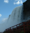
| |
| American Falls | 43°05′06″N 79°04′10″W / 43.084866°N 79.069462°W | Located between Luna Island and the New York mainland, the American Falls is the most northern and second largest of three parallel waterfalls over which the Niagara River flows. It is located entirely within the US. | 
| |
| Muddy Run Falls | 43°06′54″N 79°03′45″W / 43.114972°N 79.06252°W | Historic tributary which entered the Niagara River as a waterfall from the top of the Niagara Gorge. Development above Muddy Run Falls destroyed its water supply. | ||
| Whirlpool Rapids | 43°06′58″N 79°03′45″W / 43.116006°N 79.062488°W | 
| ||
| Colt's Creek Falls | 43°07′11″N 79°04′19″W / 43.119757°N 79.071929°W | Tributary which enters the Niagara River as a waterfall from the top of the Niagara Gorge. The volume was greatly diminished following construction of the canal to Sir Adam Beck Hydroelectric Power Stations. | ||
| Niagara Whirlpool | 43°07′13″N 79°04′10″W / 43.120219°N 79.069526°W | The Niagara Whirlpool is a natural whirlpool along the Niagara River located along the Canada–US border between New York and Ontario. The whirlpool is located in the Niagara Gorge, downstream from Niagara Falls. The whirlpool's greatest depth is 125 feet (38 m).[17] | ||
| Harvie Falls | 43°07′19″N 79°04′28″W / 43.12206°N 79.074311°W | Tributary which enters the Niagara River as a waterfall from the top of the Niagara Gorge. The volume was greatly diminished following construction of the canal to Sir Adam Beck Hydroelectric Power Stations. | ||
| Devil's Hole Rapids | 43°08′01″N 79°03′03″W / 43.133547°N 79.050901°W | 
| ||
| Bloody Run Falls | 43°08′06″N 79°02′50″W / 43.134987°N 79.047275°W | Tributary which enters the Niagara River as a waterfall from the top of the Niagara Gorge. The volume was greatly diminished following construction of Robert Moses State Parkway and other streets above the falls. | 
| |
| Niagara Power Project | 43°08′35″N 79°02′23″W / 43.142957°N 79.039807°W | 
| ||
| Sir Adam Beck Hydroelectric Power Stations | 43°08′51″N 79°02′39″W / 43.147419°N 79.04406°W | 
| ||
| Smeaton Falls | 43°09′23″N 79°02′46″W / 43.156275°N 79.045998°W | Tributary which enters the Niagara River as a waterfall from the top of the Niagara Gorge. The volume was greatly diminished following the construction of Sir Adam Beck Hydroelectric Power Stations. | 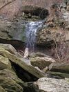
| |
| Spring Cave Cascade | 43°09′26″N 79°02′40″W / 43.157348°N 79.044372°W | Historic tributary which entered the Niagara River as a cascade from caves in the wall of the Niagara Gorge. Its source was destroyed following construction of the Niagara Power Project. | ||
| Fish Creek Falls | 43°09′32″N 79°02′41″W / 43.159018°N 79.04459°W | Tributary which enters the Niagara River as a waterfall from the top of the Niagara Gorge. The volume was greatly diminished following the construction of the Niagara Power Project. | ||
| Locust Grove Falls | 43°09′33″N 79°02′51″W / 43.159183°N 79.047532°W | Tributary which enters the Niagara River as a waterfall from the top of the Niagara Gorge. The volume was greatly diminished following the construction of Sir Adam Beck Hydroelectric Power Stations. | 
| |
| Mouth of Niagara River | 43°15′46″N 79°04′14″W / 43.262722°N 79.070646°W | 
|
Islands
Several islands are located on the upper river upriver from the falls:
| Name | Location | Country | Status | Notes |
|---|---|---|---|---|
| Bird Island | Buffalo | Filled in | Connected to Unity Island in 1822 as part of improvements to Black Rock harbor.[18] | |
| Brig Island | Niagara Falls | Park | Part of Niagara Falls State Park. | |
| Brother Island | Niagara Falls | Park | Located near Niagara Falls and the Three Sisters Islands; part of Niagara Falls State Park. | |
| Buckhorn Island | Grand Island | Park | Located on the north end of Grand Island. A state park. | |
| Cayuga Island | Niagara Falls | Residential | Located at the mouth of Cayuga Creek; a residential neighborhood of the city. | |
| Cedar Island | Niagara Falls | Filled in | Filled in by the creation of the Rankine Generating Station by Canadian Niagara Power Company in 1905. | |
| Conners Island | Niagara Falls | Filled in | Also known in some sources as "Coroner Island".[19] Filled in sometime in the 1950s or early '60s.[20][21] Currently the site of the Niagara Power Station Intake.[22] | |
| Deer Island | Niagara Falls | |||
| Dufferin Islands | Niagara Falls | Park | Man-made islands. Parkland. | |
| Goat Island | Niagara Falls | Park | Located at the brink of the American Falls, named by John Stedman in the 1770s; briefly renamed to Iris Island by General Augustus Porter, a United States Commissioner (after the Greek Goddess of the Rainbow). Now part of Niagara Falls State Park. | |
| Goose Island | City of Tonawanda | Man-made/filled in | Was located at the confluence of Tonawanda Creek and the Tonawanda Channel of the Niagara River. Existed from 1825, when the Erie Canal was constructed (thereby cutting Goose Island off from the mainland) until the 1940s, when this portion of the canal was filled in. | |
| Grand Island | Developed | The largest island on the river; includes several parks, but is mostly residential and industrial; originally called Ga-We-Not (Great Island) by the Seneca. | ||
| Grass Island | Niagara Falls | Filled in | Filled in during the 1960s to create the Robert Moses Parkway at Point Day. | |
| Green Island | Niagara Falls | Park | Originally called Bath Island, it was renamed in the early 1900s for Niagara Reservation Commissioner Andrew H. Green. Part of Niagara Falls State Park. | |
| Gull Island | Niagara Falls | Park | Located near the wreck of the Old Scow in Canadian waters. | |
| Hogg Island | Niagara Falls | Filled in | Filled in by the creation of the Chippawa Queenston Power Canal in 1917 and finally by the Sir Adam Beck Dam #2 in 1950 by the Hydro Electric Power Commission of Ontario. | |
| Little Beaver Island | Grand Island | Park | Located off the south end of Grand Island; part of Beaver Island State Park. | |
| Luna Island | Niagara Falls | Park | Located next to Goat Island; originally called Prospect Island. Part of Niagara Falls State Park. | |
| Motor Island | Grand Island | Park | Also known as Pirates' Island (the name of a private club once located there) and Frog Island (not to be confused with the former Frog Island listed below).[23] A New York State Wildlife Management Area. | |
| Navy Island | Niagara Falls | Park | Designated as a National Historic Park. | |
| Rattlesnake Island | Town of Tonawanda | Filled in | Was located just south of what is today the South Grand Island Bridge. Was filled in sometime between 1915[24] and 1927,[25] concurrent with the heavy industrial development of the area. | |
| Robinson Island | Niagara Falls | Park | Named for daredevil Joel Robinson in 1860. Now part of Niagara Falls State Park. | |
| Ship Island | Niagara Falls | Park | Part of Niagara Falls State Park. | |
| Stony Island | Niagara Falls | Unknown | Shown in the 1908 New Century Atlas of Niagara and Orleans County but not mentioned in any other source.[22] Supposedly located just offshore from the mouth of Gill Creek.[19] No longer extant, if it ever was. | |
| Strawberry Island | Town of Tonawanda | Park | A small island, formerly much larger but diminished by gravel mining and erosion.[26] An undeveloped state park and wildlife preserve.[27] | |
| Tern Island | Submerged/reconstructed | Originally known as Frog Island; was located in the Upper Niagara River between Motor and Strawberry Islands; disappeared sometime between 1951 and 1985 due to erosion.[28] Re-created as a habitat for fish, aquatic plants, and waterfowl[29][30] including a nesting colony of common terns established in 2021, for whom the new island was named.[31] | ||
| Three Sisters Islands | Niagara Falls | Park | Located next to Goat Island within Niagara Falls State Park. Originally called Moss Islands, they were later renamed for the three daughters of War of 1812 United States Army General Parkhurst Whitney (Asenath, Angeline and Celinda Eliza) in 1843. | |
| Tonawanda Island | North Tonawanda | Developed | Occupied by a marina and several industries. | |
| Tower Island | Niagara Falls | Man-made | Man-made island created in 1942 and completed in 1954 by the US Army Corps of Engineers to construct International Control Dam.[32] | |
| Unity Island | Buffalo | Developed | Home to Broderick Park, Unity Island Park, and a waste-water treatment facility. | |
| Willow Island | Niagara Falls | Man-made/filled in | Man-made island created in 1759 by Daniel Joncairs and filled in during the 1960s to create the Robert Moses Parkway. |
المواقع العسكرية
كانت محطة خفر السواحل الأمريكي في حصن نياگرا موقعًا تابعًا سابقًا لـالجيش الأمريكي. لا توجد أي مواقع لـخفر السواحل الكندي على طول النهر. تُعد كل من حصن ميسيسوگا وحصن جورج وحصن إيري حصونًا عسكرية بريطانية وكندية سابقة (استخدمت لآخر مرة في أعوام 1953 و1965 و1923 على التوالي)، وقد تحولت الآن إلى منتزهات.
استخدم حوض بناء السفن الملكي في جزيرة ناڤي من قبل البحرية الفرنسية في القرن الثامن عشر كقاعدة بحرية، ثم من قبل البحرية الملكية البريطانية بدءًا من عام 1763 كحوض صغير لبناء السفن، وتُرك مهجورًا نحو عام 1818 بعد التصديق على معاهدة راش–باگت سنة 1817.
الطرق
على الجانب الكندي، تمتد طريق نياگرا السريع على طول النهر من بحيرة أونتاريو إلى بحيرة إيري.
أما على الجانب الأمريكي، فيمتد الطريق Invalid type: NY بمحاذاة النهر من حصن نياگرا إلى ليويستون. كما يمتد طريق Invalid type: Parkway فقط على الجانب الأمريكي من شلالات نياگرا إلى ليويستون. وتشمل باقي الأجزاء من النهر (مع بعض الانقطاعات) الطرق: Invalid type: LSEX، وInvalid type: NY، وInvalid type: NY، وInvalid type: I (Niagara Thruway) / Invalid type: NYST.
انظر أيضًا
References
- ^ Inferred from Lake Erie. Retrieved 2021-01-30.
- ^ Inferred from Lake Ontario. Retrieved 2021-01-30.
- ^ أ ب "Facts & Figures - Niagara Parks, Niagara Falls, Ontario, Canada". Archived from the original (online) on December 9, 2003. Retrieved May 30, 2007.
- ^ Water Resources Data New York Water Year 2003, Volume 3: Western New York, USGS
- ^ "Niagara River Corridor". Ramsar Sites Information Service. Archived from the original on 14 January 2020. Retrieved 9 January 2020.
- ^ Bruce Trigger, The Children of Aataentsic (McGill-Queen's University Press, Kingston and Montreal,1987, ISBN 0-7735-0626-8), p. 95.
- ^ Stewart, George R. (1967) Names on the Land. Boston: Houghton Mifflin Company; p. 83.
- ^ Mobot.org
- ^ Hennepin, Louis. A New Discovery of a Vast Country in America. Chicago: A.C. McClurg & Co., 1903. Accessed December 8, 2008.
- ^ Porter, Peter (1914). Landmarks of the Niagara Frontier. The Author.
- ^ "Niagara Purchase | The Canadian Encyclopedia". www.thecanadianencyclopedia.ca. Retrieved 2021-10-13.
- ^ Electricity and its Development at Niagara Falls Archived 2009-01-24 at the Wayback Machine. University at Buffalo, June 2004. Accessed December 8, 2008.
- ^ "Niagara Falls History". Retrieved 24 October 2023.
- ^ Google (September 4, 2018). "Niawanda Park" (Map). Google Maps. Google. Retrieved September 4, 2018.
- ^ "Black Rock Canal". Encyclopædia Britannica. Encyclopædia Britannica Online. Retrieved Jan. 3, 2013.
- ^ "Chemicals of Concern in the Niagara River Tributaries - 1988-89". Ontario Ministry of Environment and Energy, Queen's Printer for Ontario, 1993.
- ^ "Whirlpool State Park - Niagara Falls, New York". Nyfalls.com. 1935-09-13. Archived from the original on 2011-08-23. Retrieved 2011-08-20.
- ^ "Waterways and Canal Construction, 1700-1825. Buffalo, N.Y." Archived from the original on February 6, 2012.
- ^ أ ب https://ngmdb.usgs.gov/img4/ht_icons/Browse/NY/NY_Niagara%20Falls_144235_1901_62500.jpg
- ^ https://ngmdb.usgs.gov/img4/ht_icons/Browse/NY/NY_Niagara%20Falls_128711_1949_24000.jpg
- ^ https://ngmdb.usgs.gov/img4/ht_icons/Browse/NY/NY_Niagara%20Falls_128712_1965_24000.jpg
- ^ أ ب Linnabery, Ann Marie (January 28, 2017). "NIAGARA DISCOVERIES: The lost islands of the Niagara River". Lockport Union-Sun & Journal. Retrieved July 14, 2018.
- ^ Island Dispatch, 16th June 1989
- ^ "Tonawanda Town 8, Riverside Land Company, Atlas: Buffalo 1915 Vol 3 Suburban, New York Historical Map".
- ^ "County Map Atlas No. 8". Archived from the original on October 2, 2006.
- ^ "Strawberry Island - Motor Island Shallows Coastal Fish & Wildlife Habitat Assessment Form" (PDF). NYS Department of State. October 15, 1987. Archived from the original (PDF) on October 16, 2020. Retrieved April 10, 2016.
- ^ "Grand Island: NYPA approves contract for Strawberry Island wetland restoration, habitat improvement". Niagara Frontier Publications. March 30, 2015. Retrieved April 11, 2016.
- ^ http://niagara.nypa.gov/EcologicalStandingCommittee[dead link]
- ^ Pignataro, T.J. (August 22, 2015). "Restoration of Frog Island hailed as Buffalo comeback story". The Buffalo News. Archived from the original on August 23, 2015. Retrieved April 10, 2016.
- ^ "Frog Island Habitat Restoration". October 2013.
- ^ Sotelo, Gabriella (September 2, 2021). "Nesting Common Terns Get a New Island Home in Buffalo". Audubon.
- ^ "Niagara River Islands History - Tower Island, Niagara Falls USA". 3 February 2017. Archived from the original on 2019-10-01. Retrieved 2019-10-01.
- Tiplin, Albert H.; Seibel, George A. and Seibel, Olive M. (1988) Our romantic Niagara: a geological history of the river and the falls Niagara Falls Heritage Foundation, Niagara Falls, Ontario, Canada, ISBN 0-9690457-2-7
للمزيد من القراءة
- Hulbert, A. B. (1908). [[1](https://archive.org/details/niagarariver00hulbgoog) نهر نياگرا]. نيويورك: G.P. Putnam's Sons.
روابط خارجية
- [[2](http://www.nflibrary.ca/nfplindex/results.asp?action=browse&q=295&key=221) مناظر نهر نياگرا] مكتبة شلالات نياگرا العامة (أونتاريو)
- [[3](http://www.nflibrary.ca/nfplindex/results.asp?action=browse&q=295&key=158) صور رقمية لجزر نهر نياگرا] مكتبة شلالات نياگرا العامة (أونتاريو)
- [[4](https://web.archive.org/web/20140701145456/http://bnriverkeeper.org/) حارس نهر بوفالو نياگرا]
- [[5](https://web.archive.org/web/20071011072645/http://niagarafrontier.com/islands.html) شلالات نياگرا والجزر] — تاريخ جزر نهر نياگرا
- [[6](https://web.archive.org/web/20140218082620/http://www.thecanadianencyclopedia.com/en/article/niagara-river/) "نهر نياگرا"] من الموسوعة الكندية
- Pages using gadget WikiMiniAtlas
- Articles with dead external links from February 2018
- Portal-inline template with redlinked portals
- Pages with empty portal template
- Short description is different from Wikidata
- Coordinates on Wikidata
- Articles with hatnote templates targeting a nonexistent page
- قوائم إحداثيات
- Geographic coordinate lists
- Articles with Geo
- Jct template errors
- نهر نياگرا
- أنهار حدودية دولية في أمريكا الشمالية
- أنهار ولاية نيويورك
- أنهار بلدية نياگرا الإقليمية
- الحدود الكندية الأمريكية
- أنهار حدودية
- ممر سانت لورنس البحري
- مناطق رامسار في الولايات المتحدة
- أسماء أماكن في ولاية نيويورك من أصل أمريكي أصلي

